To spend 2 weeks in Iceland is perfect to not only circumnavigate Iceland but to also visit the impressive highland of Iceland. If you want to drive through Iceland’s highlands, it is not easy to find a suitable route for a 2 week Iceland road trip Therefore, we researched which roads can be driven with an affordable off-road vehicle and created an Iceland itinerary for a round trip around Iceland including the highlands. The highlands in Iceland are much more isolated and quiet than the rest of Iceland.
Most tourists stay in the region around Reykjavik or drive on the ring road through Iceland. But if you want an adventure, spectacular landscapes and desert-like areas, you can’t avoid Iceland’s highlands. If you don’t have a rental car for Iceland yet, read our guide to booking a rental car or look directly at what we think is the best rental car provider for Iceland northbound.is*.
By the way: You can find important tips and information about your first trip to Iceland on our Iceland travel tips page.
Iceland Road Trip – 2 Weeks incl. Highland
After researching for a long time how a two week Iceland itinerary with the highlands of Iceland could look like, we found out that it is not that easy to find a suitable route. There are many roads in Iceland that lead through the highlands. But many of them are not passable for normal four-wheel-drive vehicles or only with huge difficulties. We have only experienced something similar on our road trip through northern Argentina. Often you need an expensive off-road vehicle to get to the most remote areas of Iceland.
Since this is not possible for most people on their Iceland road trip, we limited our Iceland itinerary to highland roads that can also be driven with a normal four-wheel drive vehicle (e.g. an SUV like the Dacia Duster). But even if we consider these routes as “passable” it does not mean that it is always possible or completely safe.

You should always be very careful on any highland road (F-Road) and especially with fords (river crossings). Always check how deep the ford is before you drive through. Damages that occur when fording rivers are not insured by most rental car providers in Iceland! There is only one provider who offers insurance for this. You can see which one in our article on booking a rental car in Iceland.
There are only 2 highland roads that cross Iceland’s highlands completely from north to south – the F35 and the F26. All other F-roads make only a small part of Iceland’s highlands passable, most of them are in the south. We have integrated the F35 (which officially is not a real highland road anymore) into our Iceland itinerary. It could also be replaced by the almost parallel F26, but then you would miss one of the top highlights of Iceland, the Kerlingarfjöll and the Hveradalir geothermal area.
In our Iceland travelogue we have marked all stops that involve driving on a highland road (F-Road) with the term “highland road“. On these routes you will only get further with a four-wheel drive vehicle/off-road vehicle. All other routes on the Iceland itinerary you can drive just as well with a normal rental car (2wd) and do not need a special 4WD for it.
Where Should I Book My Rental Car for Iceland?
It is not easy to find a good website for finding a suitable 4×4 car in Iceland. A special price comparison site for rental cars in Iceland is northbound.is*. There you will find everything from small cars to SUVs with roof tent to large SUVs and campervans. And you can cancel all cars up to 48 hours before beginning of renting free of charge.
Car Rental at the Iceland Specialist with Years of Know-How:
 Northbound.is
- compares all Icelandic car rental providers
- specialized in Iceland roundtrips and the highlands
- specialized insurances for the rough Iceland available
- free cancellation up to 48h before start of rental period
- normal rental cars, campervans, motorhomes, SUV (also with roof tent) & off-road vehicles available
Find The Best Prices for Iceland Rental Cars at northbound.is*
Summary of our Iceland 2 Week Itinerary
Our Iceland road trip is based on a classic Iceland round trip along the ring road. Because there is no other way. There are only 2 roads next to the ring road that cross Iceland completely (F26 & F35). All other routes only lead to the highlands and mostly on the same way back (like Laki) or are parallel roads or even detours.
We have tried to integrate the highlights of Iceland’s ring road and in addition to the greatest highland highlights, which are also with a normal and cheap four-wheel drive car (such as the Dacia Duster) to drive.
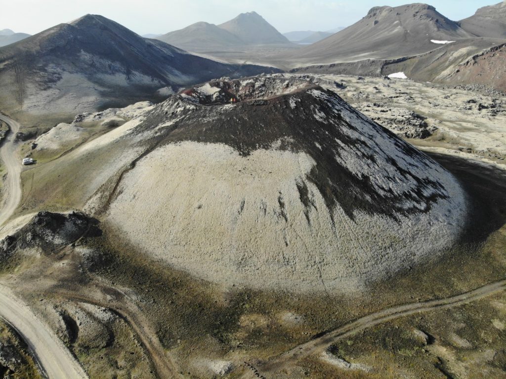 You can drive the route the same way or you can change or add things or just get inspired. For example, you should add the wonderful Westfjords to your road trip if you have a few more days. Whether you drive the Iceland round trip clockwise or counterclockwise is irrelevant.
You should rather orientate yourself on the weather and the opening hours of the highland roads, which are mostly located in the south and east of Iceland. Of course, you can also do this Iceland road trip completely without the highland roads and instead take more time or visit the Snæfellsnes Peninsula or the Westfjords.
Day 1 | Reykjavik to Vik
On your first day on your Iceland road trip you will pick up your rental car and get some groceries. You can check out the capital of Iceland on this first day and stroll around the streets of Reykjavik a bit if you need some time to arrive and get a first impression of Iceland. The capital doesn’t have that much to offer though and you’ll have seen the most important things in a few hours.
Therefore, we would rather recommend you to focus on the nature highlights of Iceland and thus head directly towards the east. Today’s destination will be the town of Vik. On the way you can visit the spectacular waterfalls Seljalandsfoss, Glufrafoss, Skógafoss and the beach Reynisfjara in the south of the island.
Seljalandsfoss
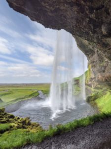
This waterfall is one of the most famous ones in Iceland and is famous for the fact that you can also go behind the waterfall, giving you a great photo perspective. Seljalandsfoss is located directly at the turnoff towards Þórsmörk (where, by the way, you can only get with a super jeep on a guided tour* ) not far from the ring road.
The waterfall plunges 66 meters into the depths and is fed by the Eyjafjallajökull glacier, which spectacularly stopped the air traffic throughout Europe in 2010. By the way, a visit is especially charming in the evening, as the sun is wonderfully positioned when you stand behind the waterfall.
Glufrafoss
Glufrafoss (or Gljúfrabúi) is only a few hundred meters away and you should bring rubber boots and a rain jacket. You have to walk through a small canyon directly through the water to get to the waterfall. 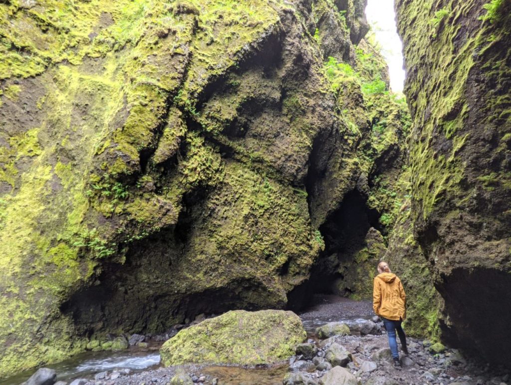 The waterfall itself isn’t even that spectacular, but the gorge you have to go through is super adventurous and it’s fun to hop from rock to rock to get through the gorge on dry feet.
Skógafoss
Skógafoss is a must-do on your Iceland road trip. The special thing about this waterfall is that you can walk to the bottom of Skógafoss and get really great shots.
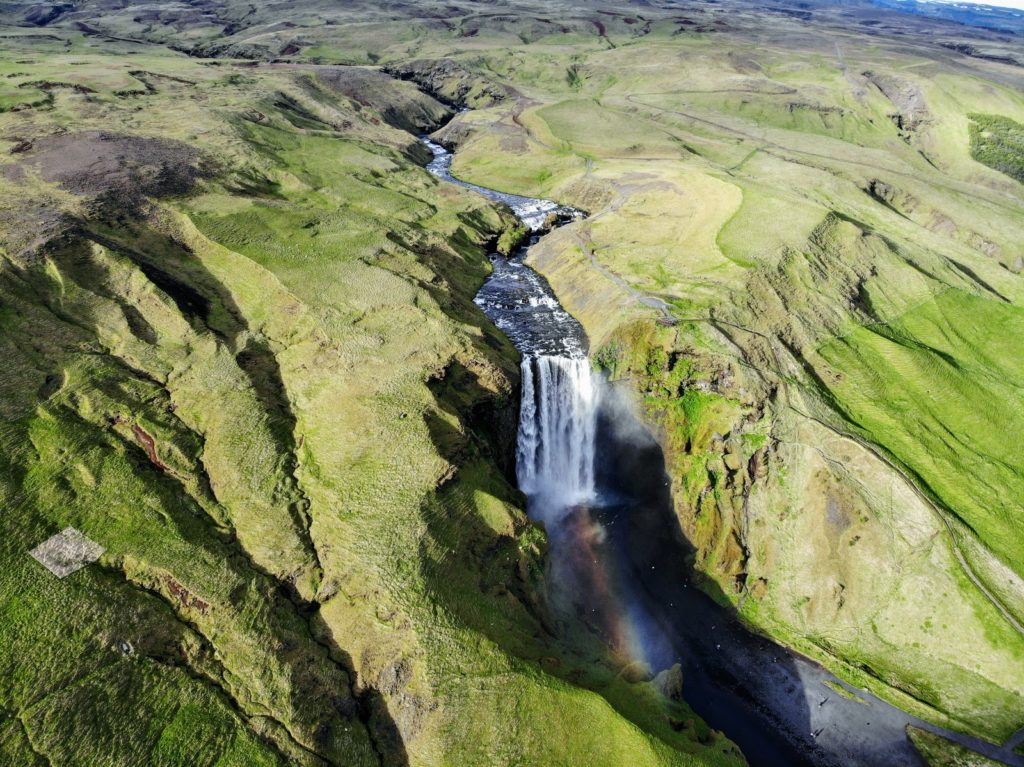
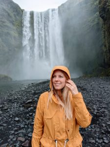 The Skógafoss pours on a width of 25 meters up to 60 meters into the depth and offers great photo spots, if you go close or zoom in with the camera. You can climb a metal staircase on the right side of Skogafoss to the top and see the waterfall from a completely different perspective. You should definitely make this small effort, because from up there starts a very special hike.
Fimmvörðuhál’s hike
East of the waterfall the famous trekking trail Fimmvörðuháls leads up to the pass Fimmvörðuháls and further to Þórsmörk. This hike is with 25 km length not easy, but worth it.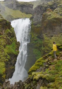
The hike is usually done in 2 days, because it is very strenuous. The destination is the camping site of Þórsmörk from where you can get back to the ring road by bus.
You can also do the hike in one day, either by being very fast or by walking only to the middle of the hike, to the Fimmvoerduhals huts (about 8km), and then turn back. Or you do like we do and just walk a few kilometers or as far as you can get and then turn around. The hike along the river Skoga is really beautiful and the further you walk the less people you will meet.
Dyrhólaey
About 13 km before Vik the road 218 turns right and brings you to the peninsula Dyrhólaey. The peninsula consists of an impressive rock plateau, which offers a spectacular cliff towards the sea, where thousands of birds (e.g. terns and puffins) breed. The way to the top, where is an old lighthouse, is very steep and leads you in serpentines to the top. But even with a normal car equipped with some driving skills you should have no problems.
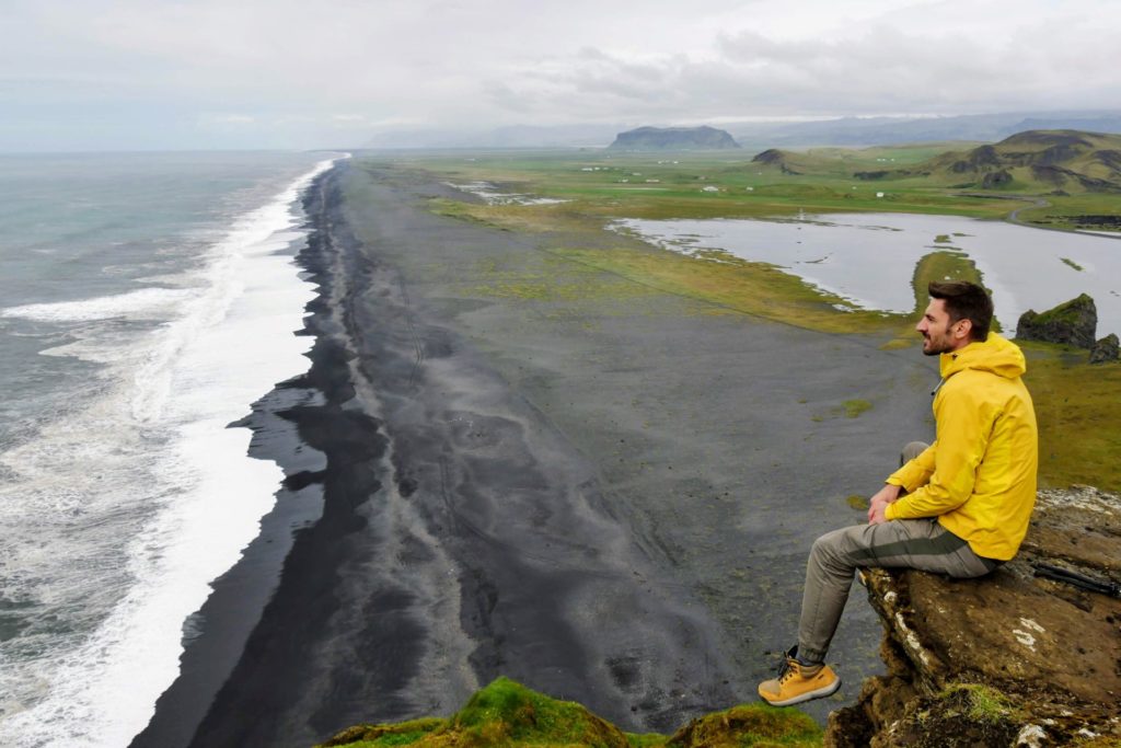 When you reach the top, you have a view of the black beach for miles to the west. On the other side of the plateau you can see all the way to the rock needles of Vik (Reynisdrangar) and you can also see a rock gate right at the foot of the plateau, through which even boats sometimes pass.
This is a wonderful view and a trip that is definitely worth it. When you go back down you can drive a bit further towards the beach, but in our opinion this is not really necessary.
Reynisfjara Basalt Columns
Just a few kilometers before Vik the road 215 turns off and brings you again to a black lava beach, where this time spectacular basalt columns are waiting for you. Directly at the sea and next to a big cave (Hálsanefshellir Cave) hundreds of columns, some of them 30 meters high, are waiting to be admired and climbed.
The nearby parking lot is free of charge and sufficiently large. You walk only a few minutes and then come to the pebble beach, where you can take great photos of you on the basalt columns. But be careful, you will not be alone here. The place is always very crowded and it is not easy to find a place where you can take an undisturbed photo.
And again, be careful: The waves here can be very treacherous and generally have an extremely strong current. A few years ago, an Asian tourist was even pulled into the sea here and drowned. So never turn your back on the waves!
Route Info
You drive the whole time on the well-developed ring road and pass many waterfalls and other sights.
- Driving distance: 190 km
- Driving time: 2,5 hours
- Highlights on the way: Seljalandsfoss, Skogafoss, Dyrhólaey peninsula, Reynisfjara beach
Overnight Stay
On this day you can stay overnight near Vik. You can either go to a camping site or book yourself into a nice hotel.
Recommendation for a camping site
The campsite is idyllically located and offers tent sites and also wooden cabins with a little more comfort.
- Vik Camping:
- http://www.vikcamping.is/(location on Google Maps)
Recommendation for hotels in Vik
Budget Hotel 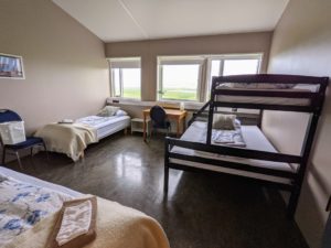
We stayed at this wonderful little hotel that was recently modernized. You are within walking distance of the famous basalt columns at Black Beach Reynisfjara. There is free breakfast in the form of coffee, cookies and cereals and you only pay about 50 Euro per night here. We felt very comfortable here.
Luxury Hotel
Hotel Vík í Mýrdal has super fancy rooms and everything you can think of. Starting at 140€ per night.
Beim Klick wird Youtube.com aufgerufen (Datenschutzerklärung) | By clicking, Youtube.com opens (Privacy)
Day 2 | Via Highland Road F208 to Landmannalaugar
Highland
Today we continue eastwards, where the southern F208 branches off from the ring road. It takes about 40 minutes to drive there from Vik. The F208 starts relatively easy but then becomes a tough highland road. You will drive the whole time on gravel roads and through moon-like landscapes, which we usually only know from the north of Argentina in the Puna de Atacama.
You will probably meet only a few other cars, but you should still be careful on the road. The way over the southern F208 was one of the most beautiful and breathtaking roads we drove in Iceland.
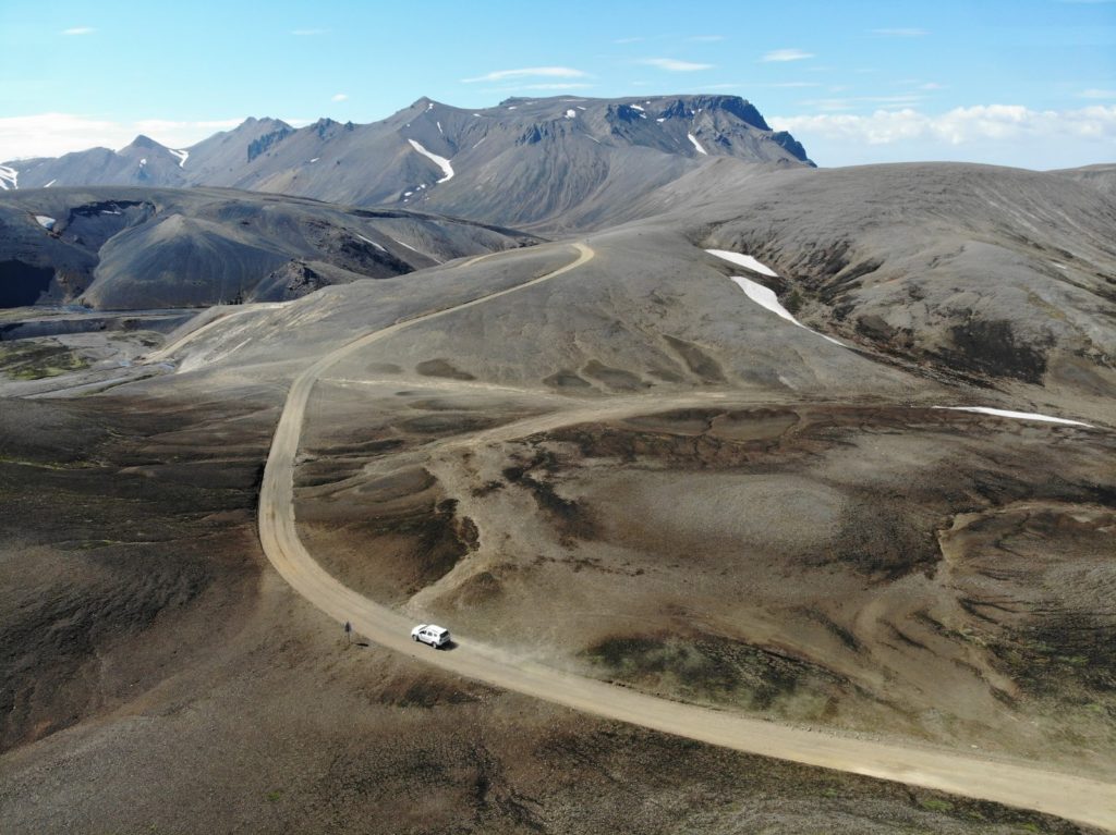 After about 2 hours you can turn right into the F235. This road is a spur road and leads to the lake Langisjór. This beautiful blue lake is 20 km long, up to 75 meters deep and is practically the destination of the whole detour. It is absolutely beautiful and off the beaten path. Each way you will be on the road for about 1 hour. At the lake itself it is really beautiful, especially when the sun is shining.
You can also take a hike around the lake or up a nearby mountain.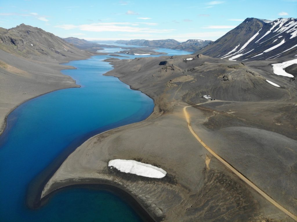 You can also just enjoy the great view and then drive back to the F208. Because the actual destination today is Landmannalaugar and you should and must take the whole day for this route. On the way stop every now and then, take pictures and marvel at the wondrous area.
Do not rush, it is much too beautiful on this route. In Landmannalaugar itself you can do numerous hikes and you should also stay overnight at the campsite there if you have a roof tent or a camper. Then you can spend the whole day there. Otherwise, you will have to turn around and go back the same way to get back to the ring road.
Route Info
After a piece of ring road you turn onto the spectacular F208. Iceland could hardly be more beautiful!
- Driving distance: 190 km
- Driving time: 6,5 hours
- Highlights on the way: Wonderful landscape on the way to Landmannalaugar
Overnight Stay
It is best to spend the night at the campsite at Landmannalaugar, where you can pitch your tent. There are also wooden cabins here. If you are not staying at Landmannalaugar, we have found the following nice hotel on the ring road in the south: Hunkubakkar Guesthouse
- Situated directly on the ring road
- Own wooden cabin in the green
- Breakfast is included
- Double room from 120 €
Hunkubakkar Guesthouse at Booking*
Day 3 of the Iceland Road Trip | Landmannalaugar
Highland
Today’s day of the Iceland highlands itinerary is entirely dedicated to hiking. You are in Landmannalaugar, an area in Iceland that is famous for its colorful mountains and diverse hiking opportunities. There are geothermal hot springs, lava fields and many different hiking trails that can last from a few hours to several days.
Landmannalaugar is located in the Fjallabak Nature Reserve in the highlands of Iceland and is most notable for its colorful rhyolite-bearing volcanic rock. Rhyolite is a rock that consists of quartz and silicon and, together with minerals such as iron and sulfur, is the reason for the colorful rock formations on site. Take advantage of the day to hike through the colorful mountains or rest and enjoy the beautiful scenery.
What you can do in Landmannalaugar and what you should consider on site, you can read in our travel report:
Route Info
Today you will drive from Landmannalaugar back to the ring road in the south.
- Driving distance: 90 km
- Travel time: 3 hours
- Highlights on the way: Wonderful landscape on the way to Landmannalaugar
Overnight Stay
Drive back south to the ring road in the afternoon, there you can look for a nice hotel not far from the ring road. Hunkubakkar Guesthouse
- Situated directly on the ring road
- Own wooden cabin in the green
- Breakfast is included
- Double room from 120 €
Hunkubakkar Guesthouse at Booking*
Day 4 of the Iceland Road Trip | Laki Crater
Highland
The Laki craters, of which there are 130 in total, are a spectacular natural phenomenon and can only be reached by a four-wheel drive vehicle. The Laki craters result from the remains of the eruptions of the Laki volcano. The largest and most famous eruption of Laki dates back to 1783 and was one of the largest eruptions of a volcano in the history of Iceland.
The area is truly an extreme example of volcanic landscape in Iceland. The series of craters is more than 25 kilometers long, over 100 meters high, and the craters are a mixture of red and black volcanic rocks.
How to get to the Laki Crater
You continue on the ring road to the east. There you turn about 6 km before the village Kirkjubæjarklaustur on the highland road F-206. To the Laki craters it is a total of about 48 km for which you should plan about 1.5 to 2.5 hours drive. The F-road 206 is only passable with an all-terrain vehicle (4×4), because some fords have to be crossed.
On the way you will pass the Fjaðrárgljúfur gorge (which is also accessible without 4×4) and later Fagrifoss. For the gorge you should plan at least 1-2 hours, for the waterfall 30 minutes are enough. After about 30 km uphill the road splits. On the left side the F-207 continues. On this route you will reach the only place to stay overnight here in the national park, namely the Blágil hut.
Not far from there is a very rudimentary campsite. But you have to keep to the right and continue on the F206. You will arrive at the Laki craters after a total of 1.5 to 2.5 hours. 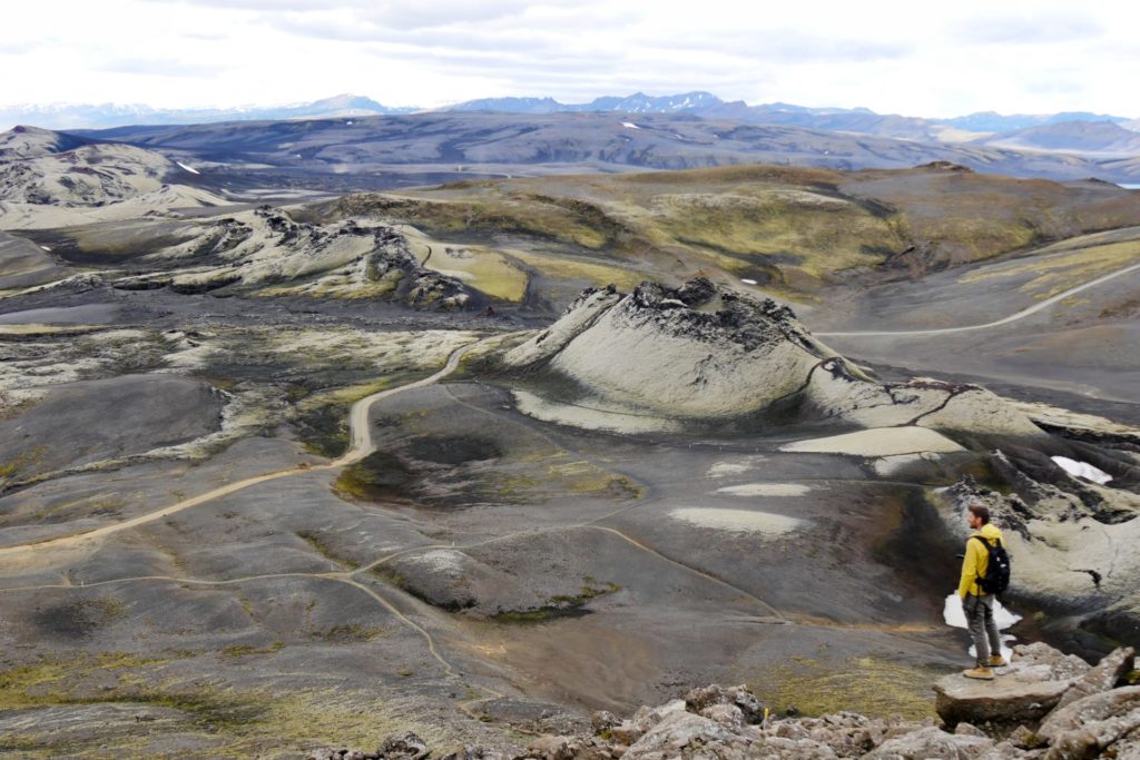 You can climb the 812 meters of the highest crater in just under 1.5 hours. Up there, you can expect a spectacular view of the craters lined up next to each other. Back at the parking lot you can follow the F-207. After about 7 km there is another parking lot. Here you can do another 2-3 hour hike. After that you can start the way back. You go back to the ring road on the same way you came.
If you took your time and enjoyed the landscape, this trip was a day trip for you and you should now look for an overnight stay. If you want to know more about our trip, then read our travelogue to the Laki craters:
Route Info
The route today goes from the ring road to the Laki craters and back.
- Driving distance: 120 km
- Travel time: 4 to 5 hours
- Highlights on the way: wonderful landscape on the way to the Laki craters
Overnight Stay
After the long day you should only stay overnight not far from the turnoff of the F206 to the ring road, otherwise the day will be too long. We have found 2 alternatives for you:
Complete wooden cabins for the whole family
In the Eldhraun Holiday Homes* up to 6 people can stay in their own cabin. You are far away from the main road and have nature to yourself. From 200 € per cabin/night.
The beautiful Eldhraun Holiday Homes*
Cozy wooden huts for 2 persons
At Hunkubakkar Guesthouse* you can get a nice wooden hut for 2 persons from 120 € per night with private bathroom.
The beautiful cabins of Hunkubakkar Guesthouse*
Day 5 | Jökulsárlon Glacier Lagoon & Diamond Beach
On day 5 of your Iceland road trip you will drive the ring road further east and after some time you will inevitably pass the largest and most famous glacier lake in Iceland: Jökulsárlon. It is located between Skaftafell National Park and Höfn and with its 284 meters it is the deepest lake in Iceland. Jökulsárlon is known for the icebergs floating on it, which can be up to 30 meters high.
On the shore of the lake there are many skuas and also seals to see. By the way, there is another glacial lake nearby, the much smaller and more remote Fjallsárlón, with smaller icebergs. There are much fewer tourists on the road and you can enjoy a little more peace and quiet. You can book boat trips on the Jökulsárlon or even take a hike on the glacier tongue.
Of course, this is not possible on your own, but only as part of a guided tour. This is best booked with the provider GetYourGuide*.
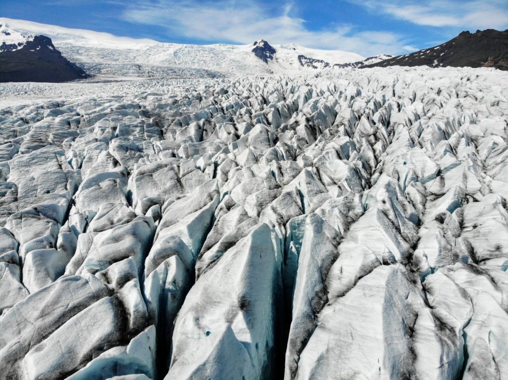 Directly opposite and within walking distance is Diamond Beach. A sandy beach with black lava sand and blue glittering ice chunks that float on the water and partly lie on the beach. The sight is really unique.
What else you can do at the glacier lagoon, where to park and more travel tips you can read in our travelogue to the glacier lagoon & Diamond Beach:
Route Info
Today you will drive from your hotel near Kirkjubæjarklaustur to the glacier lagoon.
- Driving distance: 130 km
- Travel time: 2 hours
- Highlights on the way: Glacier lagoon and Diamond Beach
Overnight Stay
There are not many hotels in the immediate vicinity of the glacier lagoon, and many are also quite expensive. But we would definitely recommend you to make an overnight stop here, because the area is just too beautiful and everything can look completely different here every day. So you should take the opportunity and visit the lagoon on two consecutive days.
On both of our visits to the glacier lagoon, we stayed at Skyrhúsid Guesthouse, which is only 10 minutes away. You are super fast at Diamond Beach and still sleep a bit away from the ring road.
- Large shared kitchen
- Lovingly furnished rooms
- located off the ring road
- 10 minutes to Diamond Beach and Jökulsárlón glacier lagoon
- Double room from 80 Euro
Camping
If you want to stay overnight in a tent, you have to drive to Höfn. There you can stay in wooden cabins or in your own tent.
Day 6 | East Fjords #1
Today you can drive along the East Fjords of Iceland on the Iceland Highlands itinerary and stop at the numerous sights of Iceland. The ring road leads here partly directly along the coast and offers a really wonderful view of the spectacular landscape of Iceland. Along the way, there are always parking lots that offer the opportunity to stop and marvel.
Of course, you won’t pass many villages. But you see a lot of sheep, cliffs and the most wondrous rock formations. Nature really shows its unusual and impressive side here. The most beautiful highlights at the East Fjords Iceland are among others the following:
Stokksness
Stokksness is a headland at the foot of the Vestrahorn. To visit the beautiful beach, you have to pay 800 ISK per person at the Viking Cafe. The friendly woman at the cafe gives you a map and explains what to see. There is also a Viking village nearby. This is a backdrop for a movie (which was probably never filmed), which is unfortunately not really kept up and therefore no longer looks so good. Of course, this does not detract from the landscape around it.
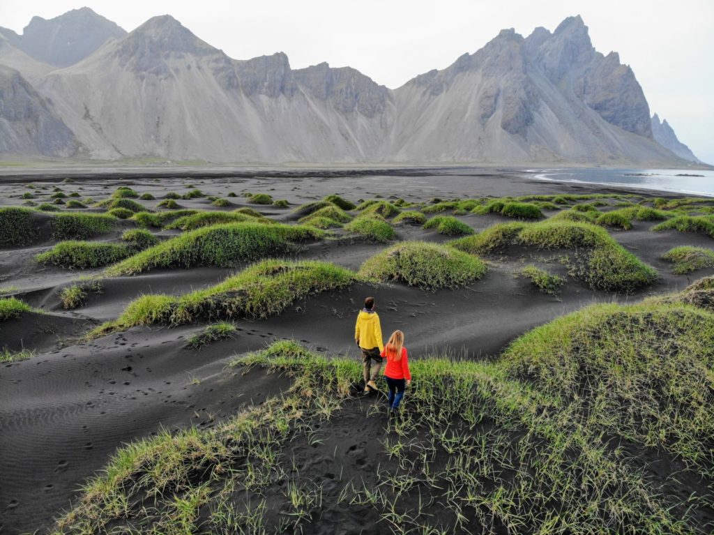 The sand on this peninsula is pitch black and as fine as on a sandy beach in the Caribbean. In addition, grass hills grow on the sand, which give the whole a special sight. The special thing on every photo that you shoot here is the mountain Vestrahorn, which is located at the beginning of this peninsula and offers a majestic view.
The combination of jet black sandy beach, green overgrown hills and the intimidating looking Mount Vestrahorn in the background is pretty awesome. For us, one of the top destinations in Iceland.
Höfn
Höfn, a small town with about 1.600 inhabitants, is the main town of the municipality of Hornafjörður and bewitches you with its small harbor and colorful houses. In addition to a small local museum dedicated to the long history of the municipality, a maritime museum and also a glacier museum invite you to visit. It is well worth taking a short walk along the harbor in the town.
The Golden Valley
The Golden Valley is an insider tip not far from the Ring Road (link to Google Maps). You don’t have to drive along a highland road, but it feels quite like it. You should not drive this route with a normal rental car.
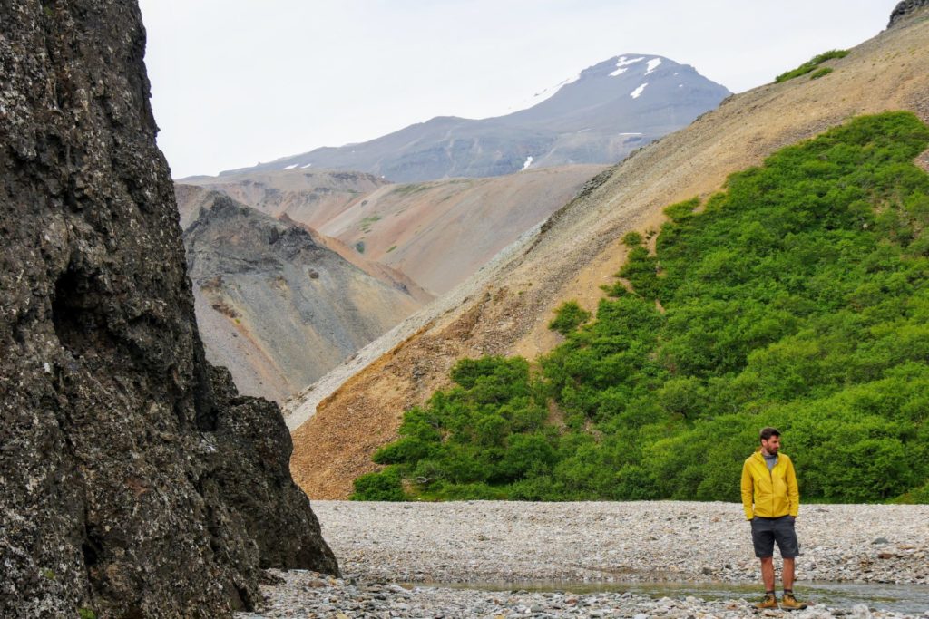 The golden valley is, as the name suggests, a valley with colorful shimmering mountains waiting for you. You walk all the time over thick pebbles and the mountains around you enchant with bright colors and loop left and right again and again, so that you do not know how far you can still walk here.
The mountains are not really golden, but the experience of walking through this narrow gorge, seeing the steep hills around you and being completely alone is very cool. If you go here, you will probably be all alone: a real insider tip.
Hoffellsjökull Glacier
Less than 10 minutes off Iceland’s Ring Road is the Hoffellsjökull Glacier, part of the Vatnajökull National Park area. You can get to the glacier easily with a four-wheel drive car. Otherwise, you can also park your car just under 4 km from the glacier and walk the rest. There are several hiking trails on site. Near the glacier there is also a nice hot pot (geothermal pools) where you can warm up for 500 ISK.
Route Info
Today you will head towards the eastern fjords of Iceland. Before that you will pass an Icelandic highlight (Stokksness) and an insider tip (Golden Valley).
- Driving distance: 230 km
- Driving time: 3 hours
- Highlights on the way: Stokksness and Golden Valley
Overnight Stay
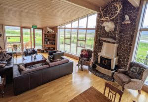
In this area there are no many accommodations, but we found a really beautiful one. The Eyjar Fishing Lodge is actually a hotel, which many fishers use. But also as a normal tourist you can stay here and have a wonderful backdrop from the huge living room windows and can relax in the evening in the jacuzzi.
- Huge cozy living room
- Whirpool
- own restaurant
- in the middle of nature
- Double room from 80 Euro
Day 7 | East Fjords #2
Today the itinerary continues through the East Fjords of Iceland. However, the main itinerary moves away from the actual fjords a bit. If you don’t plan to visit the Westfjords on the other side of Iceland, feel free to plan a little detour here.
Unfortunately, there is no road that goes along the East Fjords as in the West Fjords, but you can make detours towards the sea via roads 953 or 92. If you have less time, just follow our suggested route and enjoy the highlights along the way.
Öxi Road
You’ll have to backtrack a bit on the Ring Road to take the fabulous Öxi Road. The small detour is worth it, because the road feels like a highland road and awaits you with spectacular views.
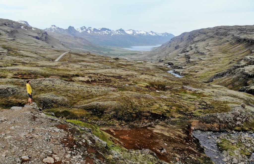 The Öxi Road is actually no longer an insider tip, because we met many other tourists there, also many with normal rental cars. If you visit the southeast of Iceland, you should drive this small side road in any case, because it offers so much more than the almost parallel ring road.
You drive here on gravel roads, but at the beginning (coming from the south) up a steep serpentine road. Once at the top, a phenomenal view of the valley stretching for miles in front of you and the waterfall next to you reveals itself. Simply fantastic!
In the further course you drive along a wildly flowing river, with some smaller waterfalls. Later on, the road gets wilder and wilder and invites you to numerous photo stops.
Hengifoss Waterfall
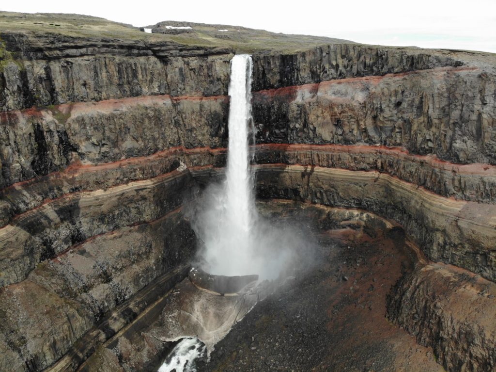
Shortly before Egilsstadir you turn left onto road 931 and drive towards Hengifoss. The large parking lot of the waterfall was already well attended when we arrived and next to a food truck is the access to the steep path to the top. This waterfall is probably not the most beautiful in Iceland, but at least one of the highest. From the parking lot you need about 1h for the steep climb to the waterfall.
The path would have actually gone a bit further, but was closed at our time because of falling rocks. But even from where we were standing, about 1km from the waterfall, you had a great view of the red layers that run through the back wall of the waterfall. By the way, these were formed by oxidized lava layers, which were formed in the last millennia.
Waterfall Circle
From Hengifoss you drive south on road 910 to another insider tip in Iceland, the Waterfall Circle. The road is asphalted throughout and therefore also passable for normal rental cars without four-wheel drive. First you wind your way up narrow serpentines and then it goes straight ahead for kilometers.
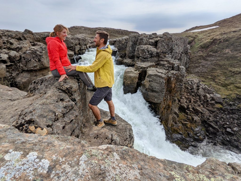 The Waterfall Circle is a great circular route on which you encounter several waterfalls. What we didn’t know was that there was also a hotel in the middle of nature, the Laugarfell Highland Hostel. Not even Google knew this lonely hostel. Right next to it is also a hot pot, but the entrance fee is 1500 ISK, so we limited ourselves to the hike to the waterfalls.
The hike itself is very special, because you hardly meet other people and the paths are hardly trodden. During our hike, the river that accompanied us was still partially covered by large snowfields and the waterfalls on the hike became larger and larger. We did not go the hike completely, because we lacked the time for it, but some kilometers we went up to a large waterfall and from there the same way back.
If you have time, you will walk the almost 8 km in 2-3 hours as a round trip. Really one of the most beautiful hikes on our Iceland trip, because it was so secluded and close to nature.
Route Info
We continue in the direction of the East Fjords. Today another insider tip is waiting for you, the Waterfall Circle. If you like to hike in peace and solitude, then this is the right place for you.
- Driving distance: 280 km
- Driving time: 4 hours
- Highlights on the way: Öxi Road and Waterfall Circle
Overnight Stay
Egilsstadir is a nice little place that reminded us quite a bit of Norway. Our hotel recommendation is close to a lake with a beautiful view of nature.
- Somewhat out of the way
- Shared kitchen
- Right next to a cozy campground
- Double room from 90 Euro
Beautiful campsite
With a sea view you can stay on a green meadow at the campsite Sólbrekka in Mjóafjörður. Per person you pay 1200 ISK. You can get more information here.
Day 8 | Stuðlagil Canyon
The Studlagil Canyon is a canyon not far from Egilsstadir, which has impressive basalt column formations and where you can also hike directly down to the bottom of the canyon. By the way, the name Studlagil also means basalt column canyon in Icelandic and there are said to be the largest number of basalt columns in Iceland. By the way, basalt columns are formed when lava cools down and the cooled lava contracts into crystal shapes.
The resulting columns are mostly vertical, but here in the canyon horizontal ones also occur. Most of the columns have a hexagonal shape (with 6 sides), but there are also basalt columns with 4 or 5 sides.
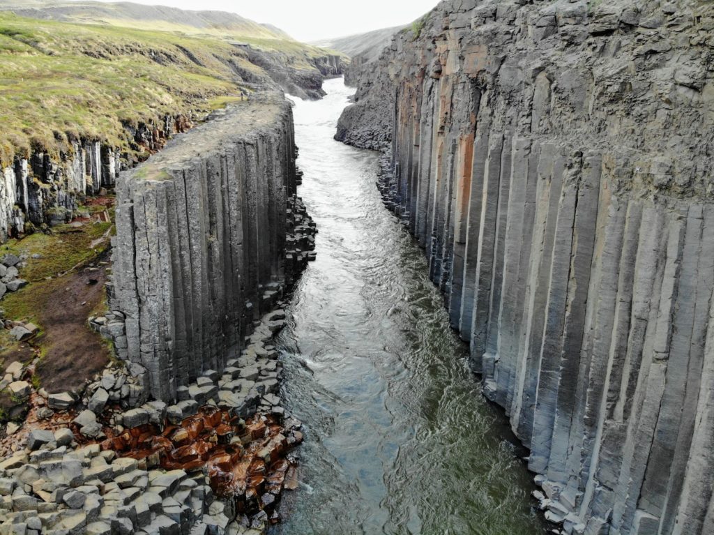 By the way, the river at the bottom of the gorge used to carry much more water here, but when the Kárahnjúkar dam was built in 2007, most of the water has been diverted through an underground tunnel to power a power plant. You drive just a few kilometers off the ring road onto a gravel road and then have to choose between 2 parking lots.
If you have little time and no desire to hike, then you continue straight until you come to this parking lot (Google Maps link). Here you park at a small campground with toilet. You can go down 240 steps on a steep metal staircase and take a look down on the gorge from a small viewing platform about 50 meters above the ground. You can’t get further down into the gorge.
If you really want to descend into the canyon and hike around, you have to drive to a parking lot that branches off the road a few miles earlier (Google Maps link). From this parking lot you can continue on a somewhat rugged road for about 2 km until you get to the 2nd parking lot. From there it is another 2 km to walk for which you need about 30 minutes. Once at the canyon, you can walk all the way down to the water and admire the canyon from all directions.
Route Info
From Egilsstadir you don’t drive long time to the canyon. There you will walk for a few hours before you continue to your nearby hotel.
- Driving distance: 150 km
- Driving time: 2 hours
- Highlights on the way: Stuðlagil Canyon
Overnight Stay
Today you will spend the night directly between Studlagil Gorge and Askja Crater in a cozy guesthouse.
Fjalladyrd Guesthouse
- cozy wooden cabins
- Breakfast included
- very quiet location
Fjalladyrd Guesthouse | check prices*
Day 9 of the Iceland Road Trip | Askja Volcano
Highlands
Askja is a famous volcano north of the Vatnajökull glacier – the largest glacier in Iceland – and is part of the Vatnajökull National Park. Askja volcano is up to 800 meters higher than the surrounding plateaus and reaches a total height of 1510 meters above zero. Askja includes several volcanoes, the largest of which has an extension of 50 km³. The most famous of the Askja craters is the Víti volcano, whose name means ‘hell’.
The Víti volcano is a volcanic crater where the water inside the crater has a temperature of approximately 30°C. That is why the crater has become a popular bathing place. Yes, you can actually go swimming in this volcanic crater! But be careful, the way down is very slippery, especially in wet weather.
How To Get To Volcano Askja
In winter it is not possible to reach Askja even with a good four-wheel drive car. But in summer, depending on the depth of the fords on the way and your driving skills, you can go there with a normal SUV (read about it in our car rental guide for Iceland) like the Dacia Duster. There are generally 2 ways to get there. One is the highland road F-88, which we would not recommend to you.
This track is only suitable for real off-road vehicles, because there are quite deep fords. But there is a parallel route, which is much easier to drive: the highland tracks F905 and F910. For Askja you should plan the whole day.
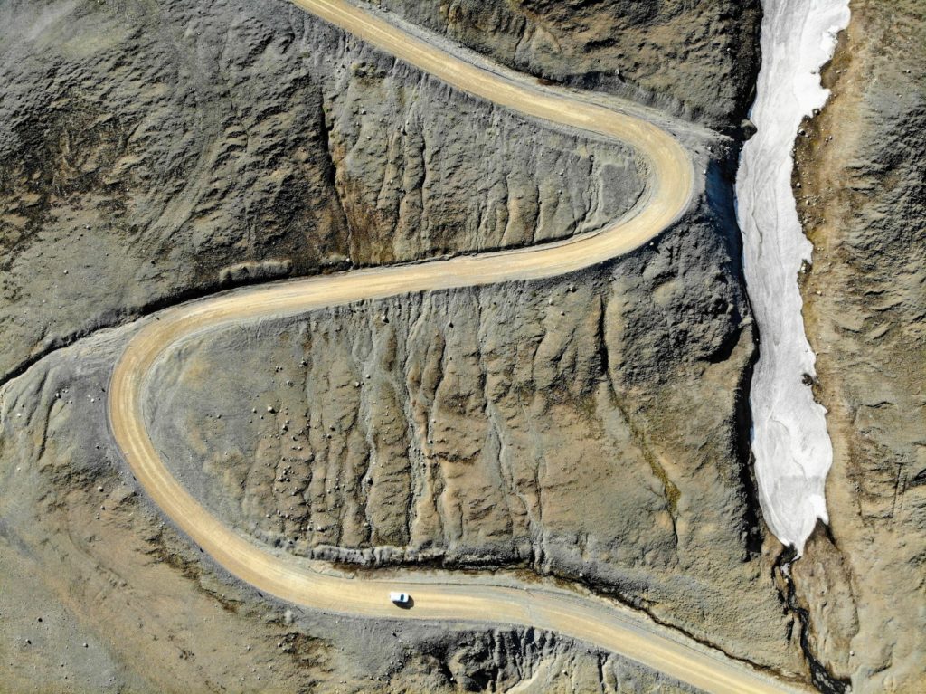
There are almost 110 km of F-roads to be covered, some of them with very difficult terrain. You will be shaken the whole time in the car. For the approach you should prefer the F905/F910 and leave the ring road at this point (Google Maps Link) and then drive over the highland roads F905 and F910 to Askja.
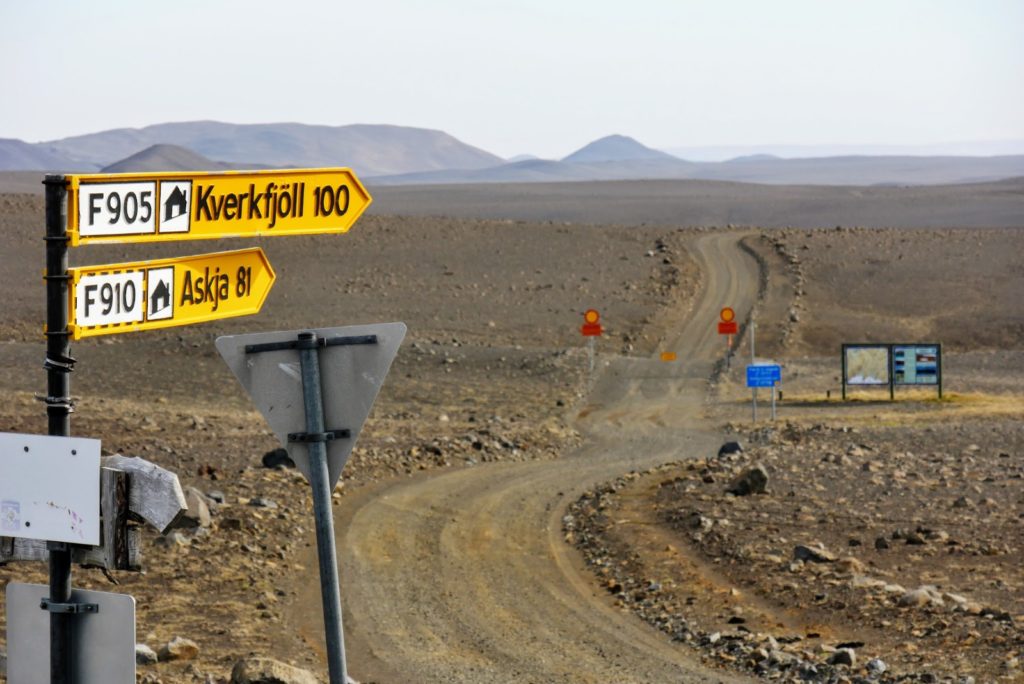
You will be on the road for almost 4 hours, crossing 4 fords. The surrounding lunar landscape is very impressive and compensates for the jerky ride. At the top there are some huts and a campground. However, this is quite expensive and the tent is pitched on stony ground. Showers cost extra.
If you have time, you should rather go back to the ring road after your hike. From this point it is not far and after another 8 km you will reach a small parking lot further up. From this parking lot you have to walk about 2.5 km to reach the crater lake where you can also swim.
 To get back to the ring road, you have to go back the same way. Unfortunately, during our Iceland road trip, the roads to Askja were still closed due to snow, so we couldn’t drive to the crater.
Route Info
The drive to Askja will take you the whole day. When you come back you should look for a nearby hotel to rest. In the next section we recommend you a nice accommodation.
- Driving distance: 100 km
- Driving time: 6-7 hours
- Highlights on the way: Askja
Overnight Stay
Since the trip to Askja can take all day, you should either stay overnight directly at Askja (see description above) or close to the ring road, so you don’t have to drive so far. We can recommend the following accommodation:
Cozy wooden cottages in a lonely area
If you don’t want to drive directly to the ring road then stay overnight in a more lonely area in cozy wooden cottages. At Fjalladyrd – Modrudalur á Fjollum you can get a double room with shared bathroom from 70 € per night.
Fjalladyrd - Modrudalur á Fjollum at Booking.com*
Day 10 | Húsavík – Whale watching in Iceland
Dettifoss
Before you get to Husavik you should turn onto road 864. This is a real gravel road and will shake you up, but you will pass the impressive waterfall Dettifoss on the way.
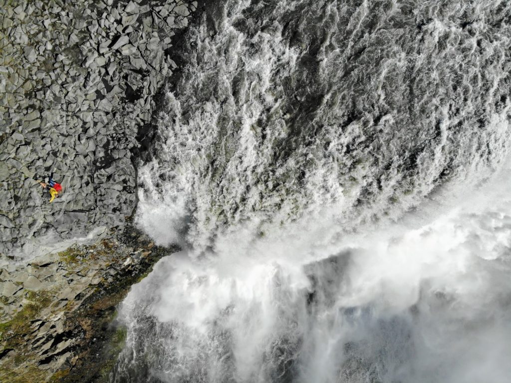 The Dettifoss pours from a height of 44 meters into the gorge and is the most powerful waterfall in Europe. We dared to come within a few meters of the roaring, marveled at the masses of water and take beautiful photos with the drone. You can get super close here, because there is no barrier. For us, the most beautiful and impressive waterfall in Iceland.
On to Husavik
Afterwards you drive further north and end up in the coastal town of Husavik. Húsavík is the capital of whale watching tours in Iceland. Almost all the whale watching tours you can do in Iceland start in this small town.
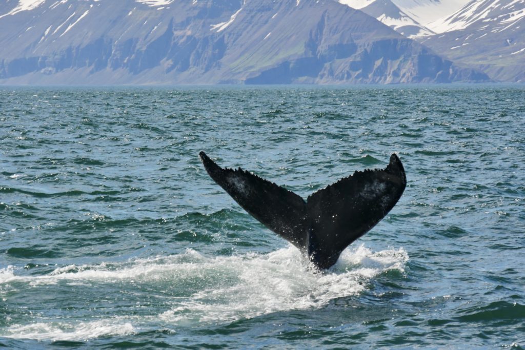
The perfect conditions for whales in Skjälfandi Bay allow for a really good success rate of almost 98% on whale watching tours in Húsavík, at least that’s what the operators say. Mainly minke whales and humpback whales can be observed in Húsavík. With a little luck also orcas and rare blue whales.
Even if you are lucky enough to see the great animals from land, you should book an organized tour. You can take a speedboat or a slower sailing ship, which is better for the animals. You can book your whale watching tours with GetYourGuide.com*. On such a tour you will be on the water for about 3 hours and you should book the tickets online in advance.
On the sea it gets really cold thanks to the wind, even if the sun is shining like during our visit. However, your provider will give you a thick seasuit that will keep you super warm. On the way back you get cocoa and a cinnamon bun. There is of course no guarantee that you will see a whale, but in the summer months you can almost count on it. Some operators will also give you a free ticket for the next day if you don’t see any whales.
Coupon for Northsailing.is If you want to book with Northsailing in Husavik, you can save a whole 15% on your booking with the following coupon code (voucher) on northsailing.is: ICHUSAVIK
We saw a humpback whale several times during our trip and quite close to our boat. A very special experience to see such a large animal so close, although we should have a much more blatant experience with a whale later in the Westfjords.
Route Info
Today we will head to Husavik. On the way you will see the impressive Dettifoss. Unfortunately you have to drive over a very bumpy gravel road. But it is worth it!
- Driving distance: 150 km
- Driving time: 1,5 hours
- Highlights on the route: Dettifoss, whales
Overnight Stay
We chose our own wooden hut between Husavik and Myvatn. The cabins are extremely secluded at the end of a long valley and are about 30 minutes from the main road. Super secluded, but also super beautiful. Laxárdalur Cabin
- located in a valley far away from the ring road
- Own wooden cabin with own kitchen and WC
- is idyllically situated on a farm
- Wooden cabin for 2 from 120 Euro
Do you prefer camping?
If you prefer camping, you can stay at Husavik campground (Google Maps link) for 1500 ISK per person.
Day 11 of the Iceland Road Trip | Mývatn
Today you drive straight to Lake Mývatn (Icelandic for mosquito lake). There are really a lot of mosquitoes here, but also many other things to marvel at. The lake is the fourth largest in Iceland and is of volcanic origin. The whole area around the lake is still volcanically active today, as the border between the Eurasian and the American continental plate also runs here.
You can drive around the lake today and take in the numerous sights. You won’t be in the car much, so you’ll have plenty of time to take pictures and enjoy the surroundings. The sights we list here can be experienced clockwise around the lake. 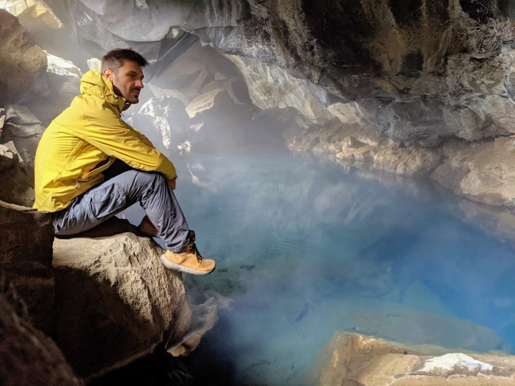
Thermal caves
There are several caves near Lake Myvatn that are filled with hot thermal water and are theoretically suitable for swimming. However, we would not recommend this as there is no information about the water quality. There are two smaller caves called Stóragjá. Here warm thermal water has collected and through small openings in the cave you can also look inside.
Much more exciting is the Grjotagja cave nearby. It is much bigger and you can walk in and look at the clear and turquoise water.
Geothermal Area Hverir
This thermal area reminds a little bit of the Hveradalir geothermal area and can be found not far from the lake. Here hot steam comes out of the earth in numerous places and also small sulfur volcanoes can be observed here.
All quite impressive, if there had not been this really stormy wind during our visit, because of which we also did not stay there long. but normally you can spend 1-2 hours here.
Höfði
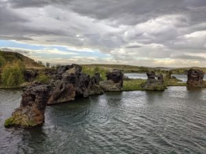
This is a small forest area with direct connection to the lake. The special thing, apart from the beautiful walks through the forest, are the unusually shaped rocks, which are here numerous in the sea. You can reach them after about 15 minutes from the small parking lot. One hour is enough to experience this place.
Iceland Road Trip – Lake Myvatn
The lake itself is not so spectacular and there are not really many points from which you have a nice view of Lake Myvatn. So the highlight of Myvatn is rather the sights around it (see above) than the lake itself. However, there is a small viewpoint on the northwestern shore that offers nice views of the lake (Google Maps link).
Myvatn Nature Baths
If you want to recover from your exhausting trip, we can recommend the Mývatn Nature Baths*. These are comparable to the Blue Lagoon* near Reykjavik, but usually not as crowded.
Route Info
You drive once around the lake and don’t sit in the car very much. The more time you have for other things.
- Driving distance: 60 km
- Driving time: 1 hour
- Highlights on the way: Lake Myvatn, thermal area, caves
Accommodation
Only 6 km from the Mývatn natural baths is the Fosshótel Mývatn. Here you get breakfast, you can rent bikes and that already from 120€ per night in a double room.
Fosshótel Mývatn at Booking.com*
Day 12 | Goðafoss & Drive to theHhighland Road F35
The twelfth day of the Iceland road trip is a driving day on the way to the highlands. But before that you will have a look at one of the most breathtaking waterfalls in Iceland – Godafoss. 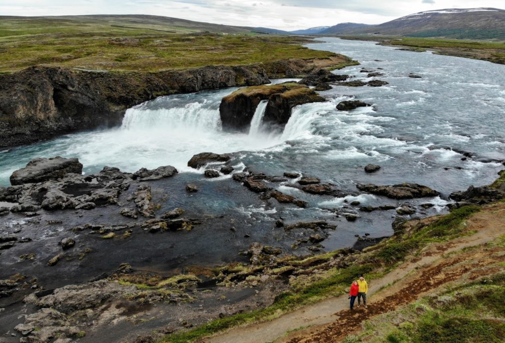
Godafoss waterfall is located not far from the ring road and is one of the most famous waterfalls in Iceland. The water of the Skjálfandafljót River, which rises hundreds of kilometers away in the Icelandic highlands, plunges about 11 meters in a large arc over a width of almost 160 meters. Since 2020, this waterfall has even been protected as a nature reserve.
Godafoss is not very high, but it has a considerable width. And also the gorge, in which he has dug in his further course is very impressive. The area around the waterfall is well developed for tourism, which is why we were surprised that we hardly met any other tourists here. But maybe it was due to the late hour, because we were here just before 9 pm.
There are some paths around the waterfall and along the gorge on which you can get down to the riverbed and admire the waterfall and the river from all perspectives. There is also a bridge over the river, so that you can easily get to the other side.
When you spend enough time at the waterfall, continue towards the highland road F35 – the Kjölur. On the way you will pass the waterfall Fosslaug. There is also a natural hot spring where you can bathe in 40 degree hot water. We have looked for a suitable overnight accommodation for you below, so that you can start the next day well-rested in the direction of Kerligarfjöll.
Route Info
Today is a driving day, but still there is at least one special waterfall on the program, the Godafoss.
- Drivingdistance: 200 km
- Drivingtime: 2,5 hour
- Highlights on the route: Godafoss
Accommodation
You should spend the night near the F35 today, so that you don’t have to drive so far the next day on the way to Kerlingafjöll.
Bólstaðarhlíð Guesthouse
- near the F35
- situated on a farm from 1825
- generously equipped rooms
- Shared kitchen
Day 13 | Kerlingafjöll & Hveradalir
Highland
The highland road F-35 is probably the easiest to drive in Iceland. There are no fords and the surface is relatively easy to drive. Nevertheless, it is an adventure to fight your way towards the highlands on this track.
Hveravellir
On day 13 of the Iceland road trip, we head back to the highlands. Your first major stop on the F35 should be the geothermal area Hveravellir. You can find some typical features of high temperature areas in Hveravellir. For example, there are hot water springs, such as Bláhver (Blue Spring) surrounded by sinter terraces, fumaroles, and the hissing Solfatare Öskurhöll (Roaring Hill).
In general, Hveravellir is a large steaming field with boardwalks leading across it. From all kinds of cracks, holes, small streams and from the meadows steam escapes in fumaroles or bubbles water. You can wander around here for hours and be enchanted by the area.
There is also a hot tub where you can take a bath. In addition, there are showers that you can use after your bath. We found Hveravellir not so exciting and for the fact that you have to pay even entrance and/or parking fees, it is actually not particularly amazing enough. But a few kilometers further one of Iceland’s most amazing areas begins.
Kerlingarfjöll is the highlight on the F35 and you should not miss it at all. It is one of the most surreal and at the same time most beautiful places in Iceland. You can experience a landscape here that no human being can imagine.
These colors, this smell, these temperatures. This place is unique in Iceland. There are many hot springs here, it steams and bubbles at every corner. And there are many hiking trails here to discover.
The F35 that leads here is very easy to drive the first half of the way, so you can drive at a max of 80-90 km/h. After the halfway point, however, the track becomes quite adventurous and you can only drive 30-40 km/h in places and even slower in stretches. The landscape is quite desert-like and gray to red-brown. After about 2.5 hours you pass the Kerlingarfjöll Mountain Resort and from there it goes steeply uphill to the parking lot for the geothermal area.
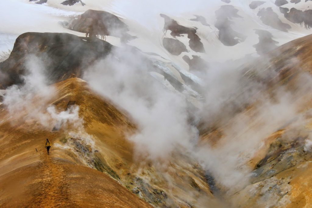
The route does not get more difficult, but much steeper and more challenging. Arrived in the thermal area it is just fantastic and better than you see it on pictures. It bubbles everywhere, clouds of mist waft around and it smells sulfurously of rotten eggs. From the actual visitor parking lot, it’s only a few feet until you have a view of the entire area.
If you go down a few more steps, you are right in the middle of it and can wander through the area on several fixed paths.
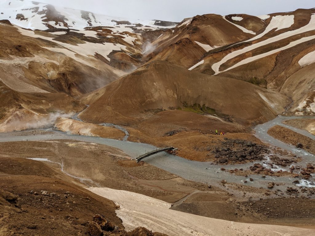 Small bridges have been built and steps carved into the mountains to make the hike as pleasant as possible. And so that people do not walk through nature unnecessarily. You can’t get enough of it here and you won’t be able to get out of your amazement. Kerlingarfjöll is unique!
If you want to know more about the journey and have more travel tips for the geothermal area Kerlingarfjöll, then read our travelogue about our trip:
Route Info
The drive is on the adventurous Kjölur, the F35. The dusty road is not easy to drive, but you will drive from north to south through the highlands and experience Iceland from a completely different perspective.
- Driving distance: 200 km
- Driving time: 4 hours
- Highlights on the way: Kerlingafjöll & Hveradalir
Overnight Stay
There is a nice hotel on site in Kerlingarfjöll that you should take advantage of, especially if you haven’t had enough of this wonderful place and want to do another hike the next day. It’s not cheap, but it’s located right in the Icelandic highlands. You won’t find any luxury here, but the nature compensates for the high price of 200€ per night.
Kerlingarfjöll Mountain Resort at Booking.com*
If you don’t want to spend so much, you have to go back to the campsite in Hveravellir or alternatively further south to the Golden Circle. Here we can recommend the following hotel:
Efra-Sel Hostel at the Golden Circle
The Efra-Sel Hostel is not far from the F35 directly in the Golden Circle and is a good end point for your highland trip via the F35 and at the same time a great starting point for the visit of the Golden Circle the next day.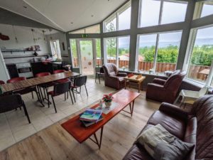
- directly at the Golden Circle
- with own whirlpool
- large shared kitchen
- nicely equipped bathrooms
Day 14 Road Trip Iceland | Golden Circle & Blue Lagoon
The two weeks in Iceland round trip is slowly coming to an end, but there is still a tourist highlight waiting for you. The Golden Circle is one of the most famous sights in Iceland and belongs to almost every Iceland road trip. But what is the Golden Circle anyway? The route is neither a circle nor is it golden here. But you get to see 3 top sights within a few hours or kilometers.
Accordingly, there are many more tourists on the road, because you can also visit the Golden Circle in Iceland as a day tourist from Reykjavik. In our opinion, you can see everything here in half a day, so we planned a visit to the Blue Lagoon for the afternoon.
Thingvellir National Park
The first highlight of the Golden Circle is Thingvellir. This is the most important historical place in Iceland and is located in the national park of the same name. Over 1000 years ago, the first parliamentary assembly in history took place here. 4000 people gathered in Thingvellir in the year 930 to discuss new laws and moderate disputes.
But the geology of the place is also very worth seeing, because in Thingvellir the rifts between the Eurasian and the American continental plate are visible and you can virtually walk between the continents. Thingvellir National Park is also home to Iceland’s largest lake (Thingvallavatn), which is surrounded by a total of four active volcanoes.
Strokkur Geyser
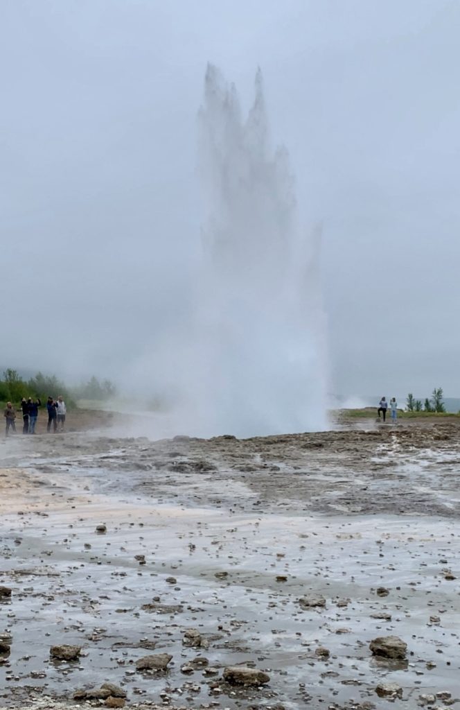
Strokkur is the most active and temporally reliable geyser in the world. Every few minutes it shoots a fountain of water several meters high into the air. Right next to it, by the way, is the geyser “Geysir”. Read correctly! Here stands the namesake of all other geysers in the world, but unfortunately it is no longer active today.
The area around the geysers is a large geothermal area. Everywhere it bubbles out of the earth and there are signs posted that you should be careful because the steam shoots out of the earth at almost 100 degrees.
The highlight of the area is the geyser Strokkur, which erupts every 8-10 minutes and shoots a steam and water fountain about 25 meters into the air.
All the time tons of tourists stand at the barrier of the geyser and wait with drawn cell phones for the next eruption. Further back you can climb a hill from which you have a good overview of the whole area. Beside the large visitor parking lot there is by the way still another restaurant and a visitor center with souvenir store here.
Gullfoss Waterfall
Gullfoss is Iceland’s most visited waterfall. The water masses plunge here from a height of 30 meters in several stages into the depth and cause a deafening noise. You should pay attention to waterproof clothes if you want to get close to the waterfall!
There is a large parking lot for visitors, where you will also find a souvenir store, and a smaller parking lot where you can park closer to the waterfall.
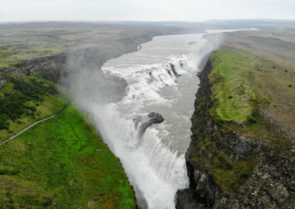 You can get pretty close to the waterfall and from the right angle you can also see a big rainbow in the spray. For us, one of the most beautiful and definitely the biggest waterfalls in Iceland.
Blue Lagoon
If you are tired of taking thousand of pictures and tired from sightseeing, you can relax in the nearby Blue Lagoon. If you’re flying home in the evening or the next morning, this spa is conveniently located near the airport and is the perfect way to end your Iceland road trip. It’s only a 30-minute drive from here to Keflevik Airport, so you can make the most of the last few hours before your flight.
The Blue Lagoon is a swimming pool that is fed with 40 degree hot water from a geothermal spring. The water here is light blue and offers a strong contrast to the black lava rock that surrounds the lagoon. The entrance fee is not exactly cheap at the equivalent of just under 45 Euro, but for that you also get a lot on offer.
There is a free drink, a free face mask and you also get free towels here. The Blue Lagoon is always very crowded, but since the area is very spacious, it gets lost very quickly and you don’t get the feeling that it’s really crowded. The tickets should be booked a few days in advance, and you also have to choose a certain time when booking. Tickets are available on the official website or also at GetYourGuide*.
We recommend booking through GetYourGuide*, because there are often still tickets for the same day, while they are already fully booked on the official website.
Route Info
Today, the Iceland road trip takes you around the Golden Circle and thus over completely paved roads. So you don’t have to think about avoiding the next pothole. Instead, you will meet many more tourists and even whole tour buses.
- Driving distance: approx. 180 km
- Driving time: approx. 3 hours
- Highlights on the way: Gullfoss, Thingvellir National Park, Geysir, Blue Lagoon
Overnight Stay
Beautiful hotel within walking distance of the Gullfoss waterfall
At Hotel Gullfoss you have Wi-Fi, breakfast and really chic rooms. In addition, you can reach the Gullfoss waterfall in a short hike. From 150€ for a double room.
The Hotel Gullfoss at Booking.com*
Your own wooden cabin in a quiet environment
Would you like to have your own wooden cabin with a garden and a great view? Then Eyvindartunga Farm Cottages are the right choice for you.
The Eyvindartunga Farm Cottages at Booking.com*
Hotel near the airport
If you fly back the next morning, you can stay in the following nice hotel near the airport:
Need more travel planning tips for your Iceland road trip? We have compiled valuable travel tips in a separate article:
Do you have any questions about the stops on our Iceland road trip? Feel free to write us a comment below our Iceland travelogue














Hi, I listed out all the things to see in Iceland but wasn’t able to figure out how move from ring road to Highlands, Your posts hepled a lot. Thanks, I have some some questions. Which month did you visit? Is the Dacia Duster Automatic or Manual? is Automatic good for F-roads and river crossings?
Hi Sharik,
we went in June. Dacia Duster is manual, which we which think is better for river crossings.
Best wishes,
Andreas