


Cap Corse is a narrow, mountainous peninsula at the very northern tip of Corsica, known for its winding coastal roads, old fishing villages and secluded coves – and for us, a Cap Corse road trip was one of the most beautiful stretches of our entire Corsica road trip.
We drove the whole peninsula in our campervan, from Pietracorbara on the east coast all the way to Saint-Florent, and here we share our complete route with every stop, sight and hike along the way. If you prefer the short version, you will also find our personal ranking of the most beautiful places in our article on the best things to do on Cap Corse.
Last updated: September 2026.
Cap Corse Road Trip Route
Our route takes you counterclockwise once around Cap Corse and passes all the best highlights along the way. If you follow our route, you will drive just under 81 miles (130 km) and need at least 4 hours. So it can be done in a single day, but then you will spend almost all of it in the car. And since the coastal road winds through constant bends to the left and right, the drive is also quite tiring.
It is better to spend 2–3 days here so you can enjoy the beauty of the peninsula without stress. We spent an entire week here and were never bored.
We cover each stop in the next chapter. If you want detailed info on the Cap Corse highlights, take a look at our article on the best things to do on the peninsula.
Cap Corse Road Trip Route in Detail
Stop A: Bastia
You will probably arrive here by ferry or plane and then, unlike most other tourists, start your route heading north. Most travelers skip Cap Corse on their route through Corsica. If you want to settle in first, take a look around Bastia’s old town, which is well worth seeing.
Stop B & C: East Coast: Erbalunga & Pietracorbara
Two of our favorite places on the entire peninsula lie on the east coast of Cap Corse: Pietracorbara and Erbalunga.
Not far from Bastia lies the small, authentic fishing village of Erbalunga with its half-ruined Genoese tower and narrow lanes; you will find more in our article on Erbalunga.
Pietracorbara, a little further north, stands out with its golden-yellow sandy beach and the cozy La Pietra campground. You will find all the details in our article on Pietracorbara.


Stop D: Tomino
From Pietracorbara we continued inland to Tomino, a small mountain village with only around 190 inhabitants. Tomino is the only village on the east coast of Cap Corse without its own harbor, but it sits on a ridge with a wonderful view of Macinaggio and its beach.
The village itself is known for its architectural heritage and is worth a (very) short stop for a photo break.
Stop E: Rogliano & Château San Colombano
Next we headed to Rogliano, one of the largest villages in northern Cap Corse, spread across several hamlets on a hillside. Above the village stand the ruins of Château San Colombano, also called Castellacciu San Colombano, a castle built in the 12th century by the Genoese noble family da Mare.

The Genoese destroyed the castle in 1554, and the ruins have been a protected monument since 1996. The climb up to the freely accessible ruins is worth it mainly for the panoramic view over the stunning surroundings.
Stop F: Barcaggio and the Sentier des Douaniers Hiking Trail
At the very northern end of the peninsula lies a very remote beach that can only be reached on a short hike. But don’t stop at the beach: you can keep walking for several more miles with a spectacular view of the sea the whole way. Plan about half a day for this, or more if you want to end the day on the beach.
You will find all the details on getting there, parking and the hike itself in our article on the Sentier des Douaniers from Barcaggio.
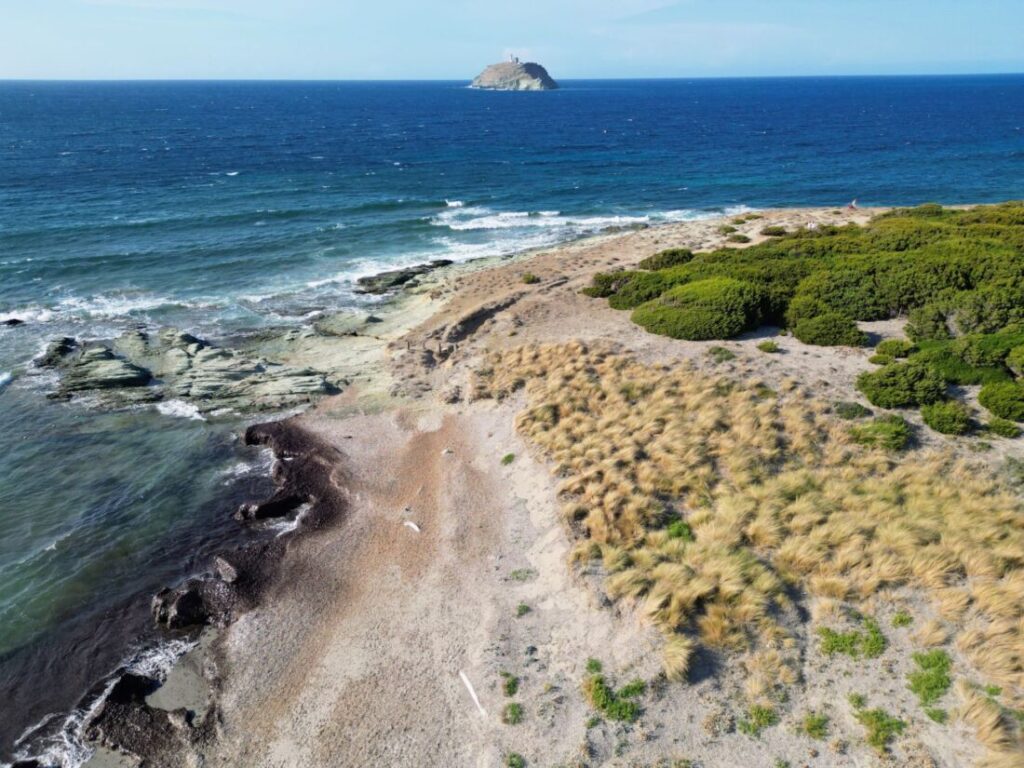
Stop G: Centuri-Port & Moulin Mattei Windmill
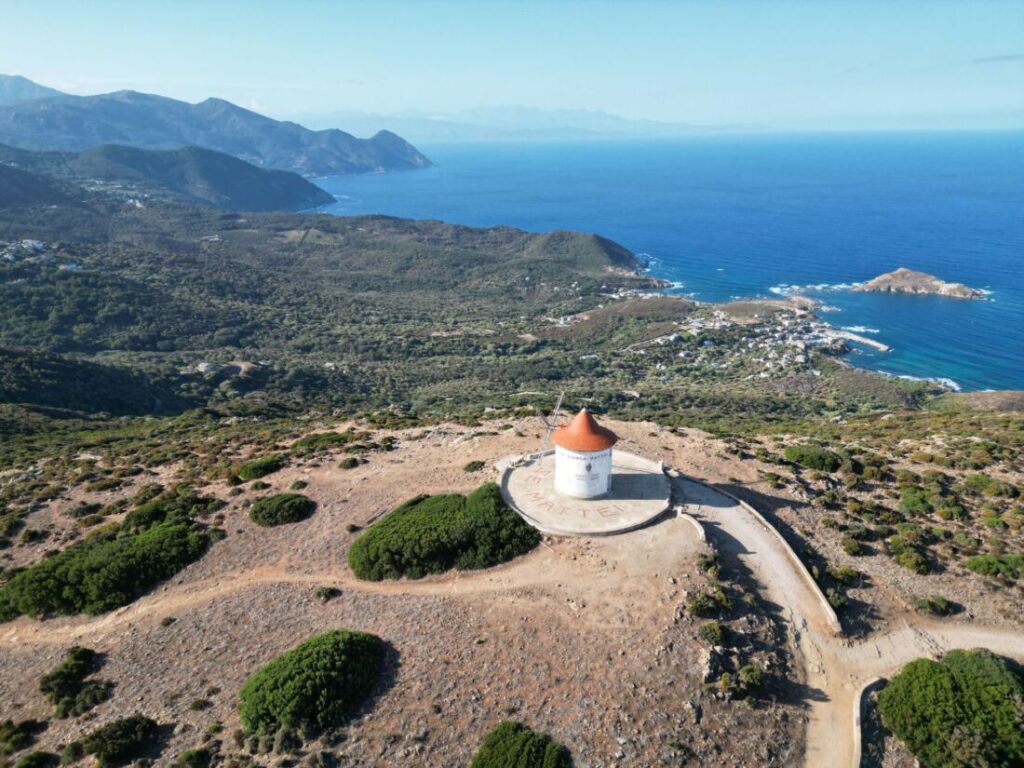
From Barcaggio, the road continues south along the west coast. You will pass the Moulin Mattei automatically, a restored windmill on the Col de la Serra between Botticella and Centuri. You get a really nice view over the coastline from the parking lot already, and it is only a few minutes’ walk up to the windmill itself.
Behind the windmill, more trails lead across the plateau, so you can also walk a bit longer here before moving on.
From the windmill, it is just a few miles to the small, idyllic fishing village of Centuri-Port. Make a short stop here and have a coffee with a view over the natural harbor.
Stop H: Albo
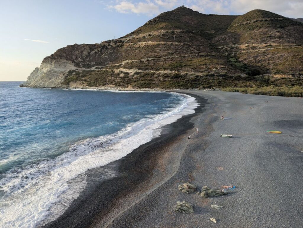
From the Moulin Mattei windmill, the road continues to Albo, a small village with a black pebble beach about 1,300 feet (400 m) long and the Genoese tower Tour d’Albo at its southern end. Despite the pebbles, the beach is really great, and thanks to its size you will always find enough room. The sunsets here are especially impressive.
You will find all the details in our article on Albo.


Stop I: Nonza
Only about a 10-minute drive from Albo lies Nonza, one of the most beautiful and best-known villages in Corsica, perched high above another black pebble beach. The main sights are the Paoli Tower, with great views all the way to Albo, and the Church of Sainte-Julie, but parking in the village is really difficult.
You will find all our tips in our article on Nonza.


Stop J: Saint-Florent
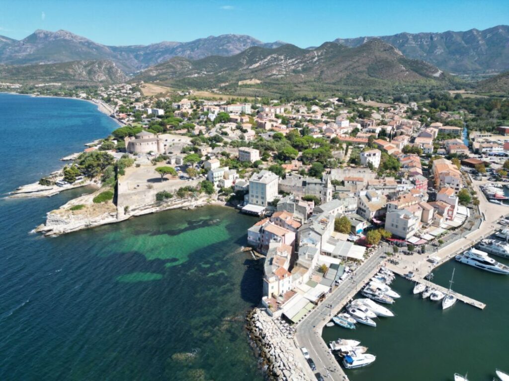
Where Cap Corse meets the Nebbio region (on the main part of the island), you will find Saint-Florent, one of the most sophisticated little towns in northern Corsica, with a Genoese citadel and a large marina. It is definitely a good place for a short stroll and has a pretty harbor and plenty of nice restaurants and cafés.
You will find all the details in our article on Saint-Florent.
Continuing Your Trip Through the Rest of Corsica
After Cap Corse, you should of course explore the rest of Corsica. You can read about the best route for that in our article Corsica Itinerary: 2-Week Road Trip. You will also find the most beautiful places on the whole island in our guide to Corsica attractions.
Practical Tips for Your Cap Corse Road Trip
What Is Cap Corse?
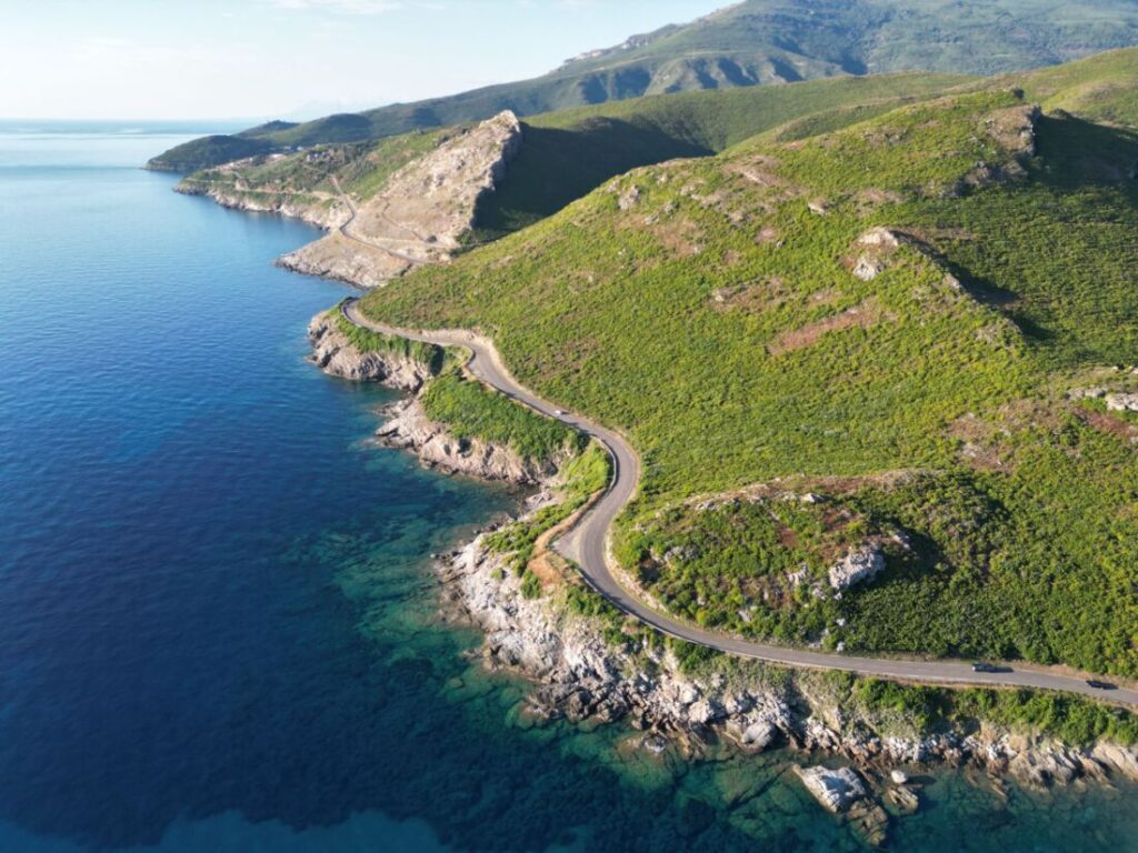
Geographically, Cap Corse is a mountainous peninsula about 25 miles (40 km) long that extends into the sea north of Bastia and is also called the “index finger of Corsica” because of its shape. The D80 coastal road links small fishing villages, old Genoese watchtowers and one spectacular view of the sea after another.
The Republic of Genoa had these round watchtowers built from the mid-16th century onward to protect against pirate raids from North Africa; with a line of sight to the next tower, the crews could warn each other of suspicious ships using smoke signals. Around 30 of these towers are said to have once stood on Cap Corse alone, more than in any other region of Corsica, and several of them (including in Pietracorbara, Erbalunga and Albo) are still well preserved today.
For the complete loop around Cap Corse, plan at least a full day including stops; you will find more in our article on the 2-week Corsica road trip.
Getting to Cap Corse
Most Cap Corse road trips start in Bastia, which you reach by ferry from the Italian mainland (Genoa or Savona). We have taken two different routes ourselves: once during the day with Moby from Genoa to Bastia, a crossing that takes roughly 5 to 7.5 hours depending on the sailing. Another time, we took the overnight Corsica Ferries sailing from Savona to Bastia with our dog and booked a cabin; this crossing takes around 6 to 9 hours.
For longer or overnight crossings, we generally recommend booking a cabin. Especially with a dog, it was by far the more relaxing option compared with the seats on deck, and we arrived in Bastia well rested and could start our Cap Corse road trip the next morning.
Tip: Book your ferry early, especially in high season, as sailings fill up quickly.
What Else You Should Know
Mobile reception was good for us in most places on Cap Corse; there were only short gaps in a few more remote stretches of the coastal road. Shops are rather scarce on the peninsula, but in the smaller villages you will usually find a small store or Spar market for the basics.
Gas stations are also few and far between, so we recommend filling up the tank before you start the loop. Ideally, drive up the east coast from Bastia first and then back down the west coast, so the views along the coastal roads get more spectacular as you go. You can technically do the Cap Corse loop in a single day, but we recommend taking a few days; the places are simply too beautiful to just drive past.
On the west coast in particular, the road gets very narrow and winding in places. If you are driving a large motorhome, take extra care and go slowly; at some tight bends, oncoming traffic can make things a squeeze.
Muscat du Cap Corse Wine Region
Several places along our route lie in the middle of the Muscat du Cap Corse wine region. It is a sweet fortified wine made from the Muscat blanc à petits grains grape and has been recognized as its own AOC (Appellation d’Origine Contrôlée) since 1993. The growing area includes Rogliano, Tomino, Pietracorbara and Saint-Florent, among others, so almost all the villages we visited on our route.
The vineyards mostly sit on limestone soils close to the sea, where the wind keeps the grapes dry and reduces fungal disease. Keep an eye out for small wineries offering tastings; around Rogliano in particular, there are several right along the route.
Where to Stay on Cap Corse
Campgrounds
We only stayed overnight in the places where we actually spent more time, so we have no campground recommendations for the pure day stops like Tomino, Rogliano, the Moulin Mattei or Saint-Florent. At the start of our Cap Corse route, we stayed at the large La Pietra campground in Pietracorbara; you will find all the details in our article on Pietracorbara.
After that, we continued to the parking lot at the Paillote Les Tamaris beach restaurant in Barcaggio, where we also spent the night; more in our article on the Sentier des Douaniers. From there, we continued to Albo on the west coast of Cap Corse, to the only free motorhome parking area we have found in all of Corsica so far. The municipal site is only about a 2-minute walk from the beach and offers a shower and tap water for tokens (€2), plus a pétanque court and a small playground.
Hotels
If you are traveling by rental car and want to spend 2–3 days on Cap Corse, we would recommend an overnight stop in the north near Macinaggio or Centuri, and then, if needed, another one in Saint-Florent.
Frequently Asked Questions About Cap Corse
How long is the coastal road around Cap Corse, Corsica?
The D80 runs around the entire peninsula, which is about 25 miles (40 km) long. For the complete loop with stops, plan at least a full day. If you follow our route, you will drive just under 81 miles (130 km) and need at least 4 hours.
Where does the Sentier des Douaniers on Cap Corse start?
The best-known starting point is the Plage de Barcaggio at the northern tip of the peninsula.
Where can you find a free motorhome parking area on Cap Corse?
In Albo on the west coast, right by the black pebble beach and only about a 10-minute drive from Nonza.
Why is Nonza difficult for campers?
Because there is very little parking in the village. It is best to arrive in the morning or late afternoon, or to park on the D80 in one of the pull-outs and walk along the road to Nonza.
How do you get to Bastia by ferry?
For example, during the day with Moby from Genoa (about 5 to 7.5 hours) or overnight with Corsica Ferries from Savona (about 6 to 9 hours); for overnight sailings, a cabin is recommended.
Are there enough shops and gas stations on Cap Corse?
Both are rather scarce, but the smaller villages usually have a small store or Spar market. It is best to fill up the tank before the loop, as there are only a few gas stations.
Is wine grown on Cap Corse?
Yes, several places on our route, such as Rogliano, Tomino and Pietracorbara, belong to the Muscat du Cap Corse AOC, a sweet fortified wine that has been recognized since 1993.