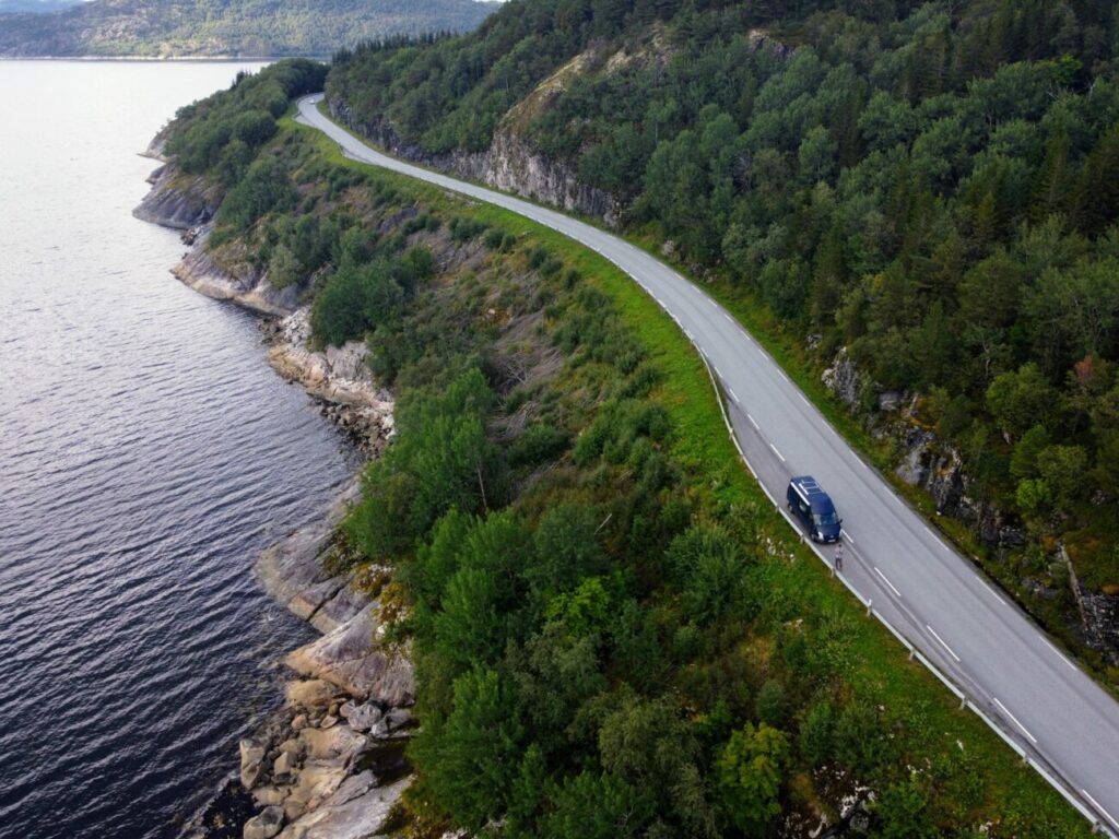
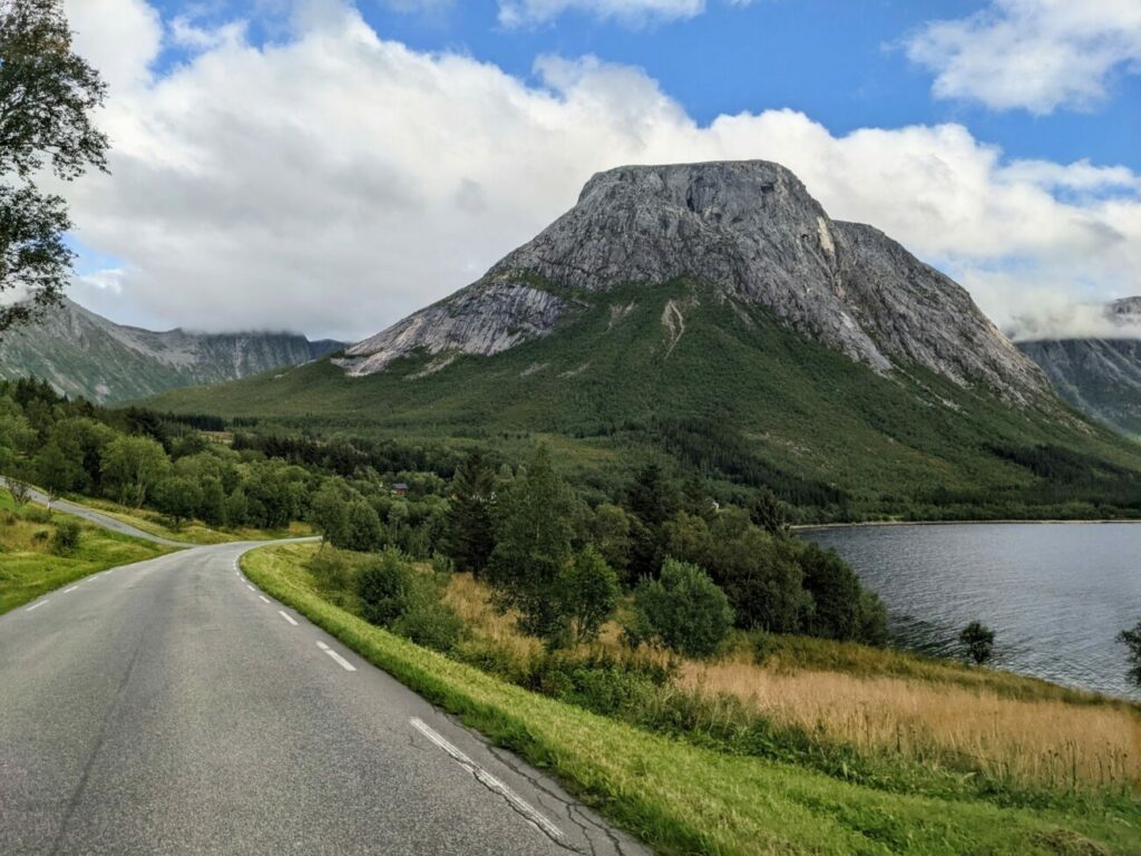
The Helgelandskysten scenic road (Fv17) is probably the most beautiful scenic road in Norway and one of the most beautiful in the world. The Norwegian scenic route Helgelandskysten, also known as Kystriksveien, runs from Bodo in northern Norway to Holm. Until then, you will cover a distance of more than 400 km, have to take 6 ferries and drive through numerous tunnels. The road often winds for kilometers directly along the coast and offers phenomenal landscapes.
What are the best things to do on the Helgelandskysten scenic road? Do you have to drive the entire stretch of Kystriksveien or are there sections that are particularly beautiful? And how much time do you need for the most beautiful coastal road in Norway? We tell you now.
Helgelandskysten Scenic Road
The Norwegian scenic route Helgelandskysten or Kystriksveien runs for 433 km mostly along the beautiful coast in northern Norway in the Helgeland region. You will drive past fjords, mountains, beaches and wonderful nature.
It starts in the north in Godøystraumen near Bodo and ends in the south in Holm. Since there are 6 ferry connections in the area, which is very rich in fjords, you will need several days for the route. But not only because of this you should spend a lot of time here, because the landscape is really beautiful and unique in northern Norway.
Alternative to the E6
Because of its location, this is a very nice alternative to the busy main route E6, which leads through the interior of the country. If you want to get quickly from the north to the south (or the other way around), the European road E6 is the first choice. The landscape along the E6 is quite beautiful (because Norway is very beautiful everywhere), but you notice that it is the main route in Norway.
You drive through many towns, there is a lot of truck traffic and and generally a lot of cars on the road. The landscape route Kystriksveien, on the other hand, is very quiet, hardly driven on and you feel like you are in another world here. Therefore, we would also recommend anyone who is on the way to Lofoten, for example, either for the outward or the return trip to switch to this side route.
Things To Do on the Helgelandskysten Scenic Road
In general, of course, we would say that the entire route is one highlight. It feels as one imagine the original Norway. Little traffic, no trucks, everything is decelerated. In addition, this nature around you, you feel as if you do not have to share it with anyone.
Nevertheless, there are some things to do on the coastal road Kystriksveien, which you should definitely head for. These include the following sights:
Saltstraumen
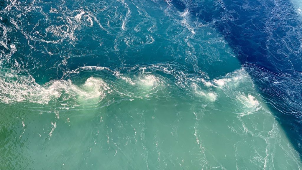
Pretty much at the northern end of the coastal road is Saltstraumen. This is a tidal stream and even the biggest and strongest in the world. A tidal current occurs when water is forced through a strait due to the ebb and flow of the tide.
The narrower and shallower the strait, the stronger the tidal current. Saltstraumen is about 150 meters wide and almost 3 km long. The hotspot of this tidal current is conveniently located directly under a huge road bridge from which you can view the whirlpool very well.
You don’t have to spend much time here and it’s even enough to drive over the bridge once, at least if you are here at the right time. Otherwise, you should stop at the free parking lot and have a look at the whirlpool up close.
You can read everything about the visit to Saltstraumen in our travel report Saltstraumen Norway | Everything you need to know for your visit
Reipa Beach
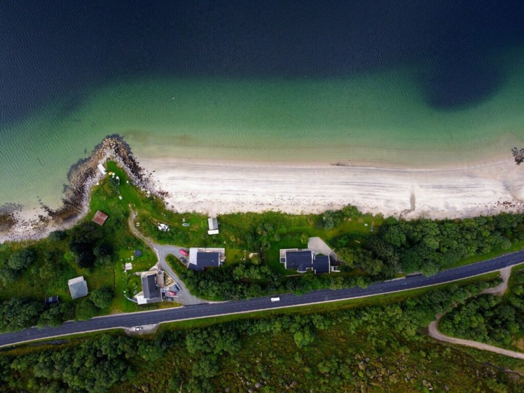
Actually, this beach (Google Maps) has no official name, but since it is located near the village of Reipa, we’ll call it that. You will automatically pass here on the coastal road Helgelandskysten and we almost drove by too, because the beach is relatively inconspicuous.
There is also a large, free rest area from which you can explore the beach wonderfully.
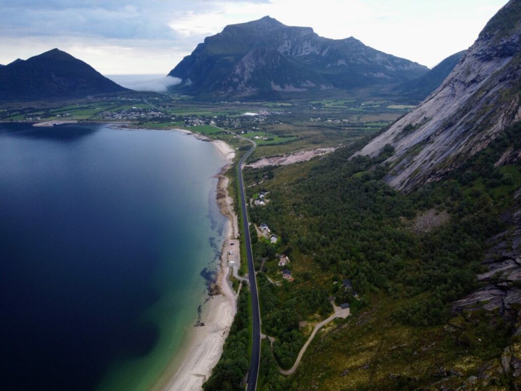
The beach is several hundred meters long and only a few meters wide, but it is still beautiful and worth a visit. The sand here is as fine as powdered sugar and you almost feel like you’re in Lofoten.
The beach slopes very shallowly and thus also invites you to swim. In the background is a large mountain range and in good weather the panorama is simply indescribable.
Svartisen Glacier
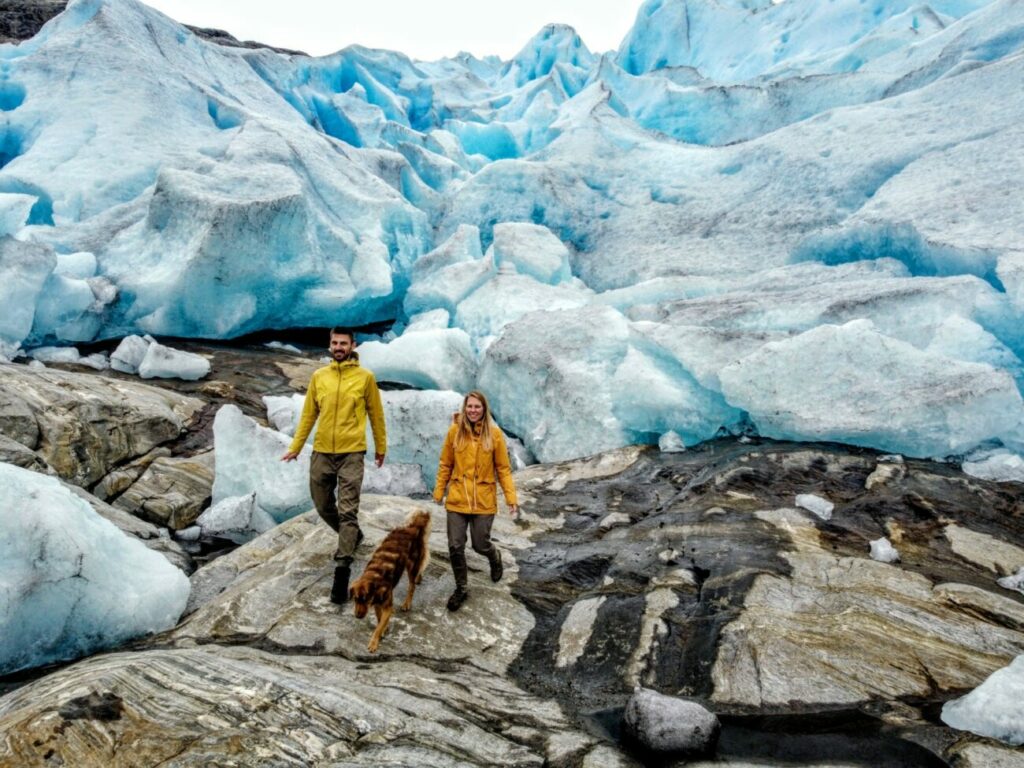
Svartisen is only the second largest glacier in Norway, but it has the distinction that no other mainland glacier is so close to sea level. This also means that you can get very close and even touch the glacier ice.
For us, the visit to the Svartisen glacier was a very special experience that we do not want to miss on our Norway road trip.
The journey to the glacier is quite adventurous, because you first have to go by boat across the Holandsfjord and then hike another 5 km until you get to the glacier tongue. There you really come directly to the glacier ice which is not self-evident even in Norway.
The route directly near the glacier is really one of the most beautiful sections of the coastal roads You drive along the Holandsfjord and see all the time various glacier arms and we were totally impressed by this panorama.
We found the hike to Svartisen glacier (or rather to its glacier tongue Engabreen) the coolest highlight on the coastal road Helgelandskysten and even one of the most beautiful sights in all of Norway. It was the first time for me to really touch a glacier and I will never forget the experience.
What you have to do to save this experience in your memories, you can read here Svartisen Glacier Hike I The Complete Guide (Parking, Boat, Hike)
How long does it take to drive the Route?
Since the entire coastal road Kystriksveien is over 400 km long, you need at least 2 days to complete the entire route. But then you drive almost the whole day. It is better if you plan more days, 3-5 days can be spent here.
If you are traveling with a camper or campervan, then you will find many wonderful sites in the middle of nature and often with a view of the sea.
We have managed the route in 2 days, but have also not driven the entire landscape route. More about that in the next section.
Do you have to drive the Entire Scenic Route?
We think no, and not only because Kystriksveien is so long. We started in the north when we drove back to southern Norway from our Lofoten road trip. Since the route from Norway’s north to the south is very long and time-consuming, we couldn’t take much time for this.
And unfortunately, since there are also a total of 6 ferries to overcome, the whole thing can be quite drawn out. The ferry trips are quite good to plan, because the departure times can be found on Google Maps. But ferries sometimes fail, or there are already so many cars in front of you that you have to wait for the next ferry.
All this can extend the journey time by hours and that unplanned. But that’s not the only reason you don’t have to drive the entire Helgelandskysten route to the end. We found the northern part of the route much more spectacular than the southern part.
Therefore, if you don’t have so much time, you can also just drive the stretch between Leira (Google Maps) in the south and Bodo in the north. Here a more than 10 km long tunnel (25 €) leads back to the E6.










Wow, this is useful. Thank you! ☺️