Landmannalaugar is located in the highlands of Iceland and will be one of the top highlights on your road trip through Iceland. Landmannalaugar should definitely be on your itinerary, because just getting there is beautiful. In Landmannalaugar, you can go hiking, enjoy the beautiful scenery and bathe in a natural hot spring.
Which route to Landmannalaugar in Iceland is the most beautiful, where to park and how many days you should plan, we tell you now in our guide with the best travel tips for a day in Landmannalaugar.
Landmannalaugar in Iceland I Highlight in the Highlands
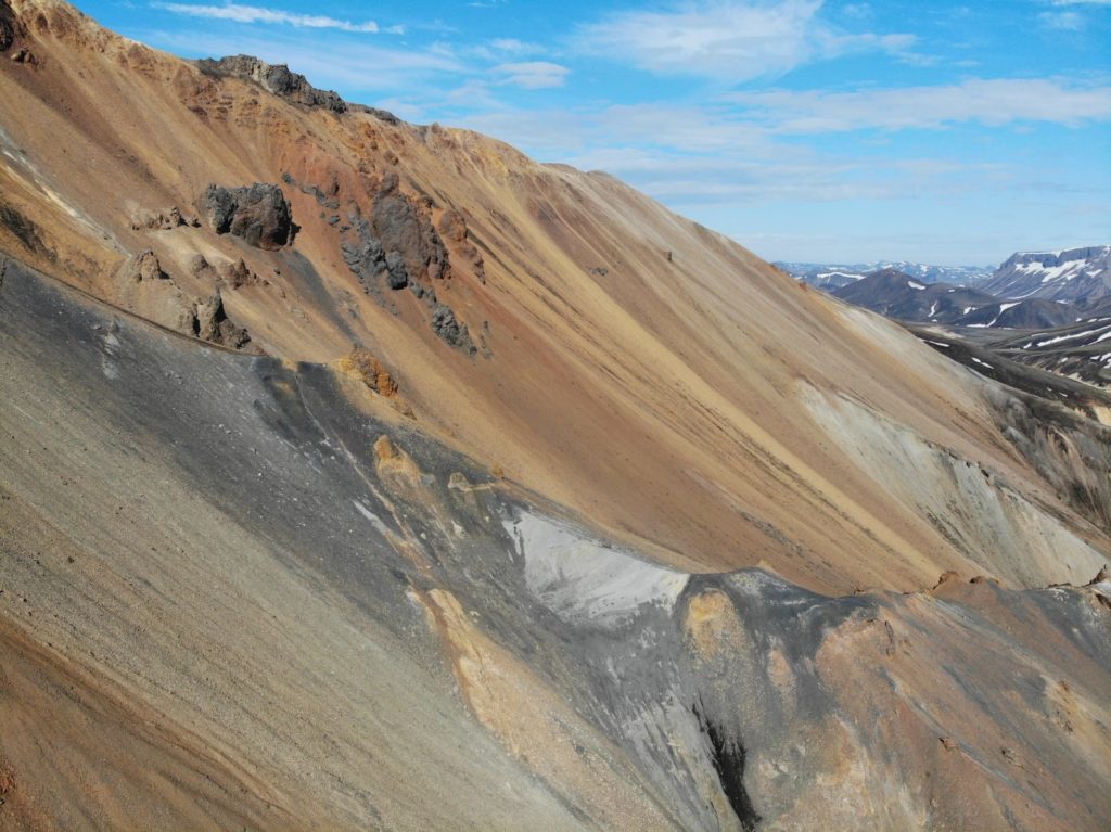
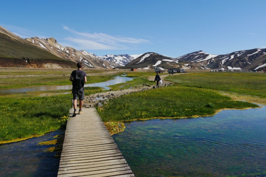
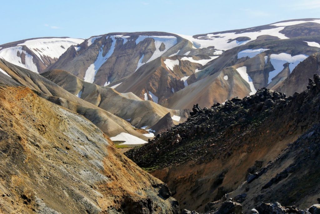
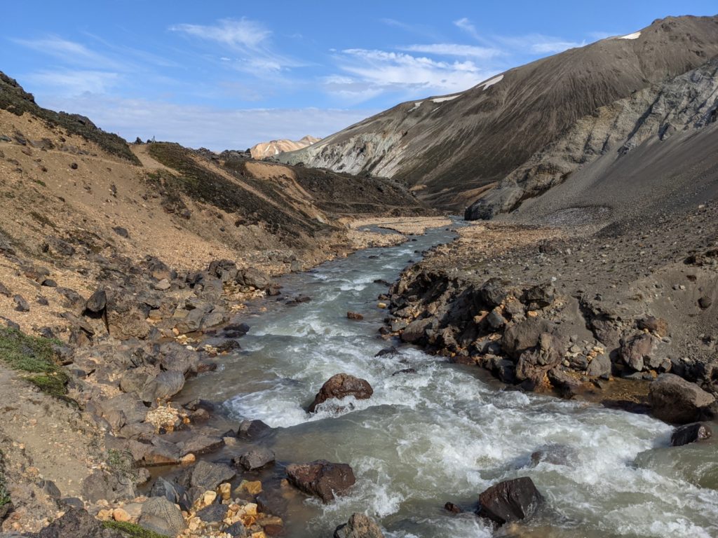
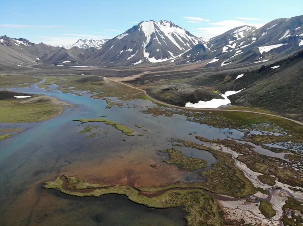
Landmannalaugar is a wonderland of rainbow-colored mountains, black lava fields and hot springs. Landmannalaugar is located in the Fjallabak Nature Park in the middle of the highlands of Iceland. The mountains and lava fields are the result of thousands of years of volcanic activity. The huge Laugahraun lava field, for example, was formed after a volcanic eruption in 1477.
The rhyolite mountains surrounding the area offer an incredible play of colors and are unique in this accumulation in Iceland, making Landmannalaugar one of the most beautiful areas in the highlands of Iceland.
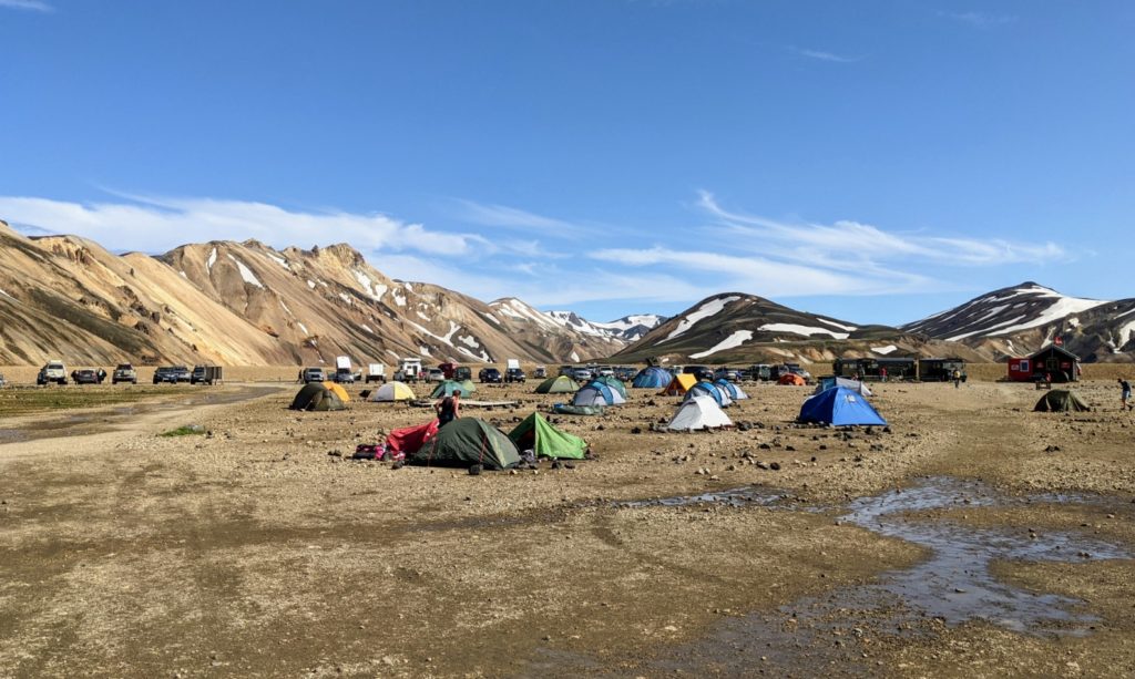
Landmannalaugar in Iceland also has a large campground located in the valley and surrounded by the colorful mountains. The campsite offers space for tents or campervans and overlander vehicles. In the middle of the spacious area there is a large hut where you can learn about the landscape, the campsite and also the various hiking trails. Also hiking maps can be purchased here.
A bit off the beaten track are 2 old American school buses, which supply you as a “Mountain Mall” with the most necessary food. You can spend several days here and try out the various hikes. But also in one day you can explore the area and especially the way there. Already the journey to Landmannalaugar in Iceland offers very special landscape experiences.
Beim Klick wird Youtube.com aufgerufen (Datenschutzerklärung) | By clicking, Youtube.com opens (Privacy)
How to get to Landmannalaugar in Iceland I Which Road is the most beautiful?
There are several ways to get to Landmannalaugar in Iceland and most of them are beautiful. We want to describe and evaluate the different possibilities.
But all roads to Landmannalaugar in Iceland have one thing in common … they are unpaved gravel roads (F-Roads) and you have to cross rivers most of the time. This means that you need a 4×4 vehicle with 4×4 drive. With normal rental cars it is neither allowed nor possible to get to Landmannalaugar. Which rental car you should get for Iceland’s highlands, we have compiled in our Iceland rental car guide.
If you don’t have a rental car for Iceland yet, read our guide on how to rent a car in Iceland or go directly to the best agency for rental cars northbound.is*.
From the North via the F208 | The Easiest Route
Route Info:
- Duration: about 2.5h from the ring road
- Difficulty: easy
- Scenery: quite nice
You drive from the ring road over the 26 to the north and then turn to the east on the 208. This is not yet an F-Road and therefore still paved until you reach the hydroelectric plant. Only 26 km before Landmannalaugar the gravel road begins.
This is the easiest route to Landmannalaugar in Iceland and should be manageable in any case. There are also no river crossings here, so that you should arrive safely even with a normal SUV without high ground clearance.
From the North via the F225 | Medium-Difficult Route
Route Info:
- Duration: about 2.5h from the ring road
- Difficulty: medium
- Scenery: very beautiful
From the ring road you drive north on the 26 and then turn east on the F225. This road is a little harder to drive, but there are no major fords and the route is much more scenic than the route via the northern F208.
Even with a normal off-road vehicle or SUV you should manage this route without any problems.
From the South via the F208 | The Most Beautiful Route to Landmannalaugar
Route Info:
- Duration: approx. 5h from the ring road (incl. lake detour); approx. 3h without lake detour.
- Difficulty: difficult (many fords)
- Landscape: breathtaking
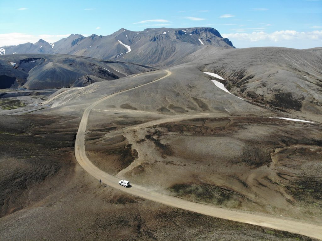
We chose this route for the journey to Landmannalaugar in Iceland, because it is considered to be the most beautiful. And what can we say, we found the journey almost more beautiful than Landmannalaugar itself. The landscape on the route is insane and simply beautiful.
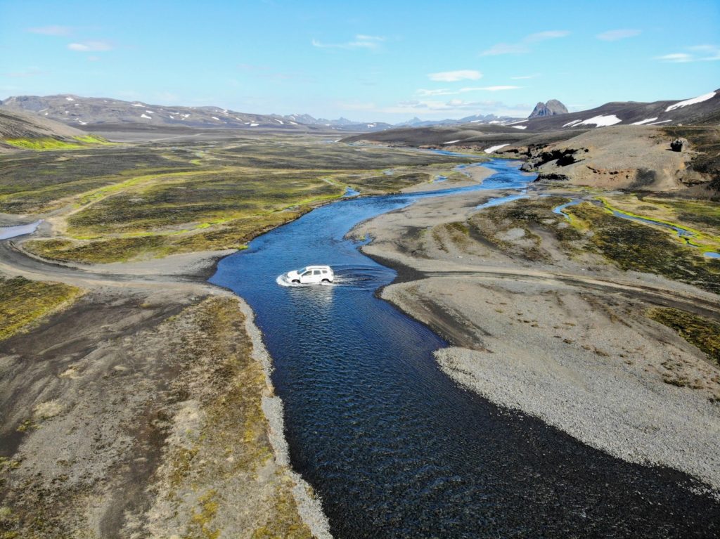
The route is incredibly varied and leads over mountains and through valleys and completely inhospitable areas. A risk with this route are the many fords on the way. There are probably 40-50 rivers and streams that you have to cross. But only a few of them are really challenging. But these are absolutely doable with a normal off-road vehicle (e.g. an SUV like the Dacia Duster). At least that was the case during our visit in July 2021. Of course, you should follow the rules for river crossing in Iceland and first walk through the river and in case of doubt rather turn back.
Small Detour: Lake Langisjór
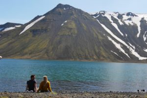
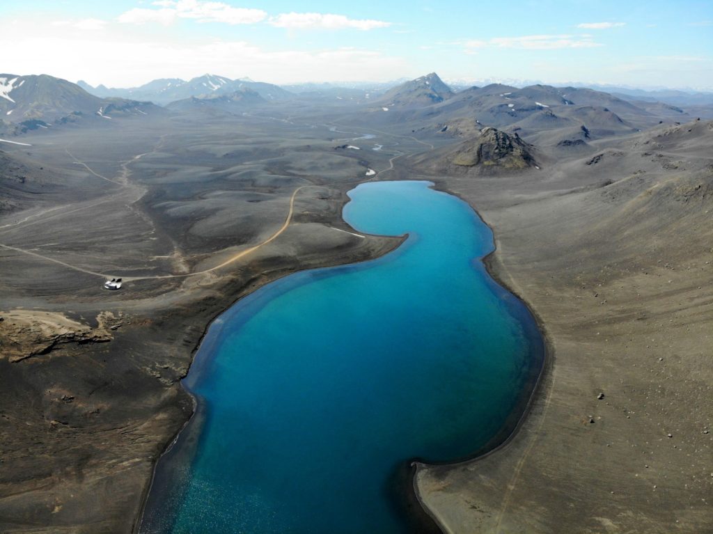
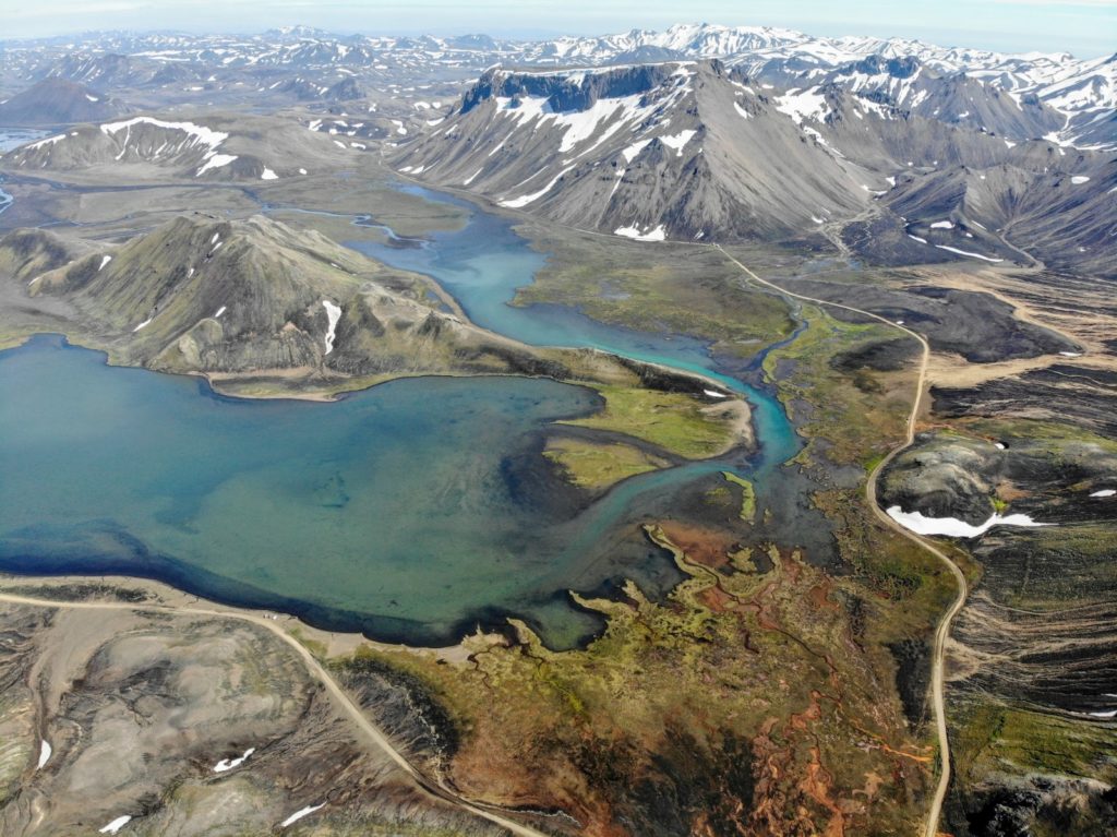
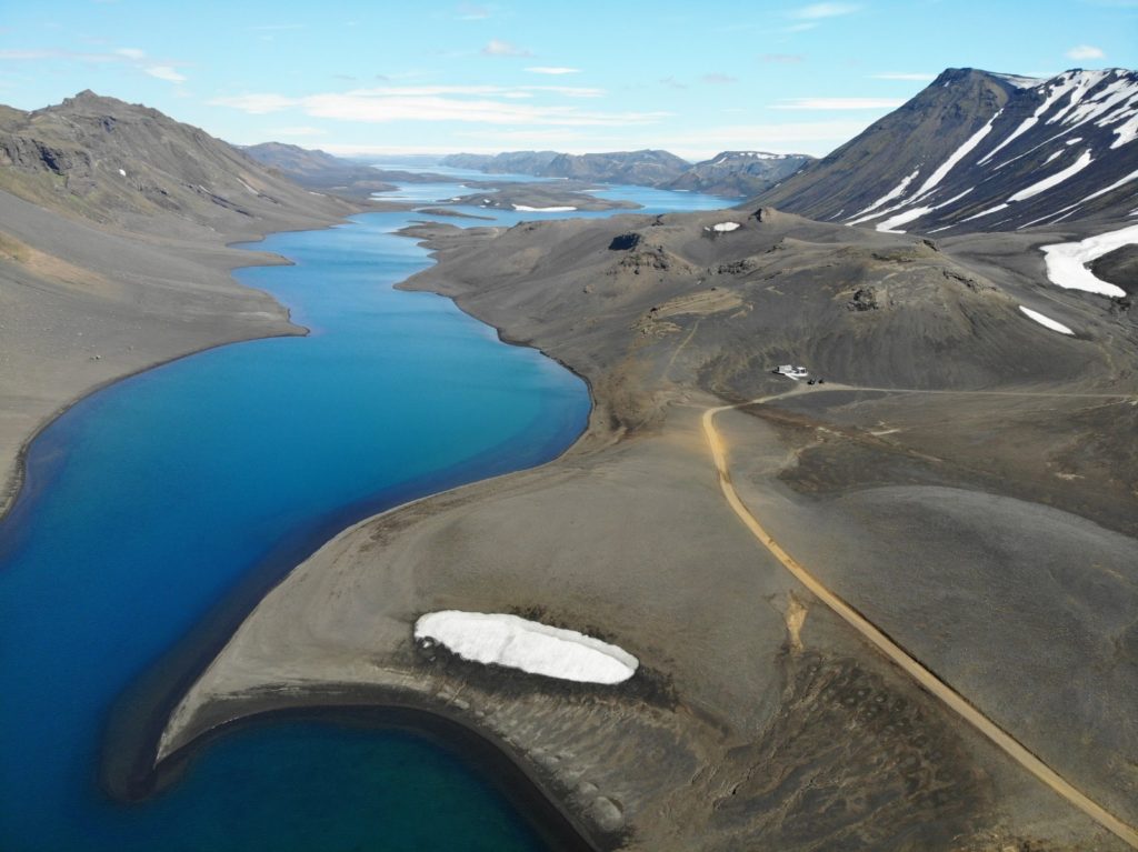
Another advantage of this route is also the lake Langisjór, which is only a small detour of about 1 hour away from the F208. You should definitely take this detour, because the route itself is already incredibly beautiful, but the lake tops everything again. Lake Langisjór is about 20 km long and shines in a wonderful turquoise blue.
There are hiking trails around the lake and up a nearby mountain. You will probably be almost alone here and then you will be in one of the most fascinating areas of the highlands.
It took us over 5 hours to get to Landmannalaugar in Iceland including the detour to the lake from the ring road.
Arrival by Bus
There are several bus companies serving the route from Reykjavik to Landmannalaugar. The buses run from mid-June to early September. The trip costs about 7500 ISK (55 Euro) each way and takes about 4.5 hours. You will save time and money if you start from Selfoss or Hella instead of Reykjavík, because these places are on the bus route.
More information about the bus routes can be found on this website.
If you want to do an organized tour, for example because you don’t have a rental car suitable for the highlands, you can find a suitable tour on GetYourGuide*.
What to do in Landmannalaugar?
There are many sights and activities in Landmannalaugar in Iceland. What you can do in Landmannalaugar we want to tell you now.
It´s not the Destination it´s the Journey
As so often in Iceland, it´s not the destination it´s the journey. We arrived via the southern F208 and left via the F225 and especially the southern F208 was just spectacular. We spent more time on the route than in Landmannalaugar itself. And we didn’t find that bad at all, because the highlands of Iceland are one of the most breathtaking landscapes in the world and the routes around Landmannalaugar are a special highlight.
Hiking
Landmannalaugar is famous for its hiking trails. You can spend several days here and explore the landscape on various hikes. Which trails there are exactly and how long and strenuous they are we tell you below.
Hot Pot
After an exhausting day of hiking you can step into the natural hot spring (hot pot) and relax.
You definitely won’t be alone here, but since the hot tub is located in a river, you’ll have plenty of space.
There are no changing rooms, only a small wooden platform where you can put your clothes. If you are staying at the campsite or have paid the per diem, you can use the washrooms in the nearby lodge to change and shower.
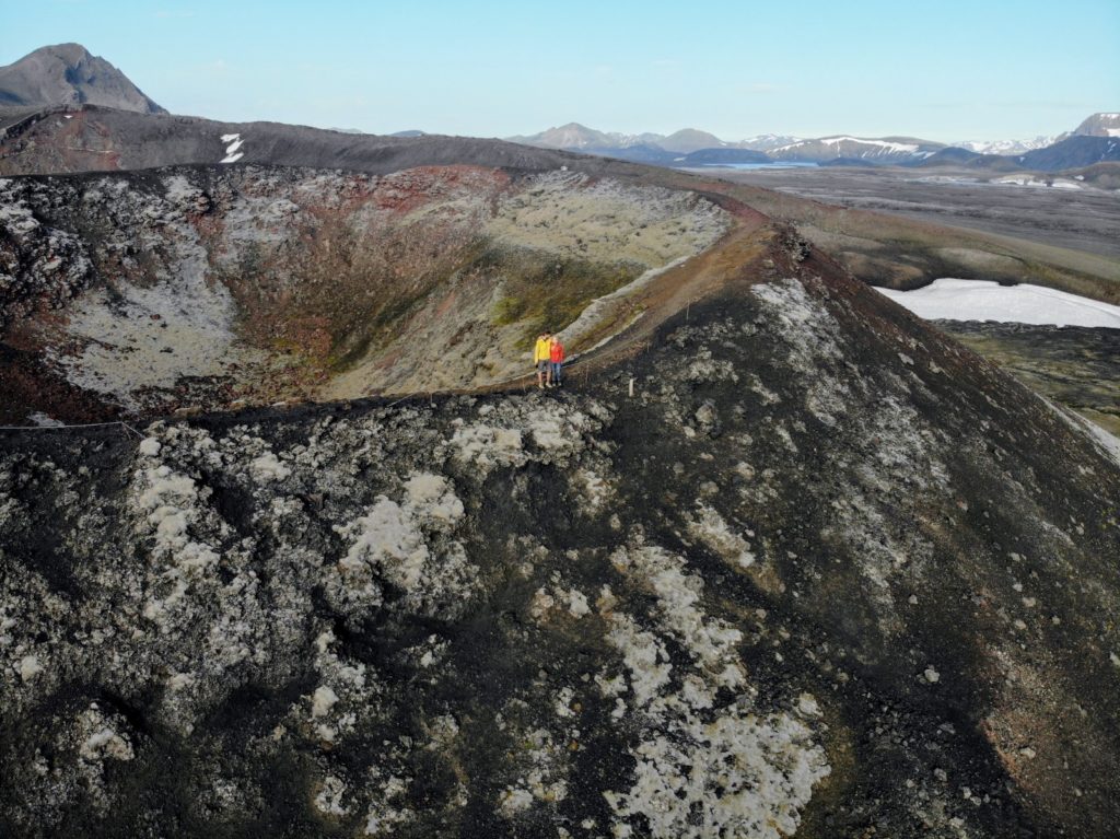
Stútur Volcano
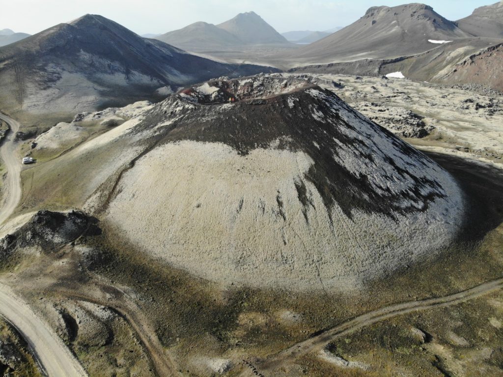
Only a few minutes away from Landmannalaugar is the volcano Stútur. You can park directly in front of it and climb to the top of the volcano via a staircase at the back.
At the top you can walk once around the crater and have wonderful photo perspectives, especially with a drone.
Hiking in Landmannalaugar | Our Recommendations
There are many hiking trails in Landmannalaugar over colorful and often snow-covered mountains, making this area a hiker’s paradise in the Icelandic highlands. In just one day you can hike 2 great trails here and then finish off with a dip in a hot tub.
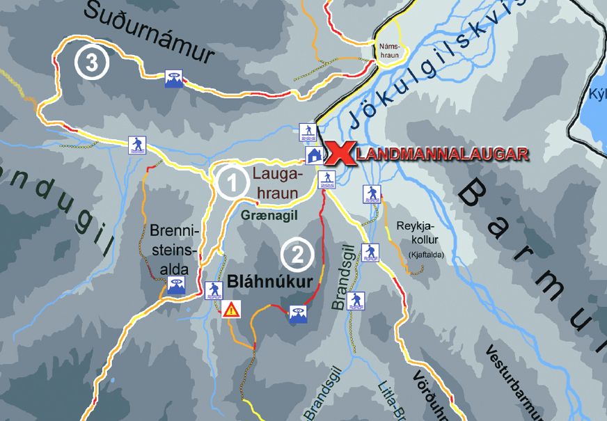
On site there is unfortunately very insufficient information about the individual hiking trails. For example, there is no big information board with information about the individual hikes. So you should prepare yourself well before you arrive. I have linked the official hiking maps of Landmannalaugar for your travel planning:
If you only have one day in Landmannalaugar in Iceland, then I would recommend the following two hiking trails. These are the most popular hikes in Landmannalaugar and can easily be fit into a day trip. In total you will walk about 5h and 10 km respectively. If you don’t want to walk so much or simply have less time, then we describe below a shorter hike of about 1.5 hours around the lava field Laugahraun.
Mount Bláhnúkur (Blue Peak)
The hike to the top of Blahnúkúr is also called Blue Peak. This trail is very strenuous and is also considered the most difficult hike in Landmannalaugar in Iceland. But the view from the top is phenomenal.
- Distance: 6 km
- Duration: 3 hours
- Difficulty: Difficult
From the campsite you walk south along the riverbed until after about 500 meters (right next to the start of the Laugahraun hike) the steep ascent begins. After you have reached the top, the steep descent begins, where you arrive near the Laugahraun lava field and walk a short distance along the Laugahraun hiking trail. You can follow this trail until you arrive back at the campsite.
Alternatively, after a few minutes you can start the second hiking trail on the Brennisteinsalda.
Brennisteinsalda (Orange Mountain)
Brennisteinsalda volcano (also called Sulphur Wave) is another quite strenuous hike to the top of a mountain. This hike is a bit shorter and easier than the hike up Blahnúkúr. There are breathtaking views of the landscape from here as well.
- Distance: 6,5 km
- Duration: 2 hours
- Difficulty: medium
You start at the campsite and walk past the community building to the west and cross the small river that feeds the natural hot spring, then you walk uphill towards the Laugahraun lava field. After a while, a path branches off to the right that will take you up onto the volcano. If you descend on the other side you will arrive at the Laugahraun hiking trail again and from there you can either take the shortest way back to the campsite or hike up to Bláhnúkur again.
Combine Bláhnúkur & Brennisteinsalda
- Route: 10 km
- Duration: 5 hours
- Difficulty: difficult
You can also combine the two hikes described above, because the hike to Brennisteinsalda starts shortly after the end of the Bláhnúkur hike. Here I have summarized how you can combine the two hikes:
- From the campsite you walk 500 meters south to the start of the Blahnúkúr hike.
- You hike up to the Mount Blahnúkúr
- When you have descended, follow the yellow markings towards the Laugahraun lava field.
- You then turn left and follow the red markings on the Laugahraun trail
- Then turn right and follow the green markers to the top of Brennisteinsalda (direction Vondugil)
- Then follow the white and green markings through the valley towards Landmannalaugar.
- Then follow the white and red markings through the Laugahraun lava field back to the campsite.
Laugahraun Hike | If you have only little time
Distance: 4 km
Duration: 1.5 hours
Difficulty: easy
If you, like us, have already spent too much time on the journey and then have only a few hours on site, then we would recommend the following hike. In the middle of the lava field Laugahraun a narrow path leads to the valley behind and to the foot of the active volcano Brennisteinsalda.
You start at the campsite and walk south for about 500 meters where the path to the top of Bláhnúkur is located. But instead of going steeply uphill you keep to the right of it and go through a small valley, while to your left the steep path winds up to Bláhnúkur.
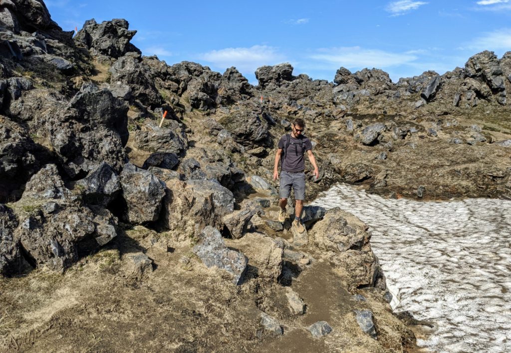
You walk the whole time along or even through the lava field. After a few kilometers a geothermal field is waiting for you where hot steam is coming out of the earth in several places.
The path is very easy to walk, because there are hardly any slopes. Of course you don’t have such spectacular views as on the hikes to Bláhnúkur or Brennisteinsalda. Nevertheless, you walk here through a beautiful and exciting landscape.
Tips for visiting Landmannalaugar in Iceland
Parking at Landmannalaugar
Directly at the campsite of Landmannalaugar there is a large official parking lot. To get here, you have to cross the last big ford, which small SUVs (like the Dacia Duster) can’t drive through. Only if you have a big SUV (like a Landrover) you can drive to the big parking lot without any problems.
If you have only a small SUV, then you have to stop in front of this ford and park your car there. But you are not alone there, because there are 50 cars and more parked at high times. From there you have to walk about 500 meters to the campsite, which is no problem. By the way, parking here is completely free.
Best Time to visit Landmannalaugar
Landmannalaugar in Iceland can be reached approximately from mid-June to mid-September. So you need to get to landmannalaugar when it’s summer. But this depends less on Landmannalaugar itself, than on the roads that lead there. Because Landmannalaugar is located in the highlands of Iceland and only so called F-Roads (highland roads) lead there. When these roads open is not always the same. You should therefore check the website road.is before your visit to see if the access roads are open.
Landmannalaugar in Iceland is not accessible during the winter months.
How long should I stay in Landmannalaugar?
You can experience the best and most beautiful here in one day. But you should be aware that it will take you 12-14 hours to get back to your accommodation. If you have the time, then it makes sense to stay overnight in Landmannalaugar and spend 2 days here.
Overnight Stay in Landmannalaugar
There is a large campground in Landmannalaugar, where you can camp with your campervan or rental car with roof tent or with normal ground tents.
The camping costs 1200 ISK (8 Euro) per person.
You can also sleep in a cabin for 9500 ISK (65 Euro) per person. But here you sleep in shared rooms with bunk beds. Information about the campsite can be found here.
More Tips
There is no gas station in Landmannalaugar. As always when you go to the highlands, you should fill up at the ring road.
There is no restaurant, but there is a small supermarket on site, which will provide you with the most necessary things.
You need an off-road vehicle with four-wheel drive (4×4) to get here. But a small SUV like a Dacia Duster or a Suzuki Jimny is also sufficient. What exactly you have to pay attention to when renting a car in Iceland we tell you here.
If you only make a day trip to Landmannalaugar, then it will be a long day for you. So you should leave as early as possible.
Our Experience in Landmannalaugar
We started near Vik and drove along the southern F208 towards Landmannalaugar. The road started to become beautiful and very varied after a few kilometers. There are also a lot of fords (>40) to cross here, but most of them are no problem at all. Very often we had to stop to take pictures of this breathtaking landscape or to let the drone rise in this inhospitable area.
The route wound left and right around mountain ranges, sometimes running deep in the valley then again high up over a mountain ridge. We were really fascinated by this beauty around us.
Lake Langisjór
After about 2 hours we turned right onto the F235. This dirt road is a spur road and leads to Lake Langisjór. This wonderful blue lake is 20 km long and up to 75 meters deep and is quasi the destination of the whole detour. But in reality, of course, the journey itself is the goal here. It is absolutely beautiful.
On the route there are also a lot of fords of which most but rather small and many are simply large puddles. We drove past moss-covered mountains, through stone-gray deserts and streaked loamy brown ridges. For us, one of the most beautiful highland stretches in Iceland.
The destination of the trail was hidden behind a small ranger station and a large reddish-brown hill. Lake Langisjór lies majestically in front of you and stretches almost to the horizon. What an amazing landscape!
We drive the last hundred meters down and meet at the end of the road on a small building, which was probably once a campsite, which is currently being renovated. Here is not much going on except a few men and 2 little girls who play with a dog.
We join them and are glad to see other people after many hours. In complete calm we lie down on the lakeshore and admire the nature. It is really warm, we play with the idea to jump into the water, but quickly discard the thought. Around the lake leads a hiking trail and also a nearby mountain peak can be climbed here and enjoy a phenomenal view.
Further towards Landmannalaugar
Unfortunately we don’t have time for that, because we have to go on to Landmannalaugar today. So we leave with a heavy heart and drive back to the F208. This time a little more courageously, because we know the fords already and therefore dare a little higher speeds, so that the water splashes only in such a way. All in all, this little detour took us just under 1h each way, but we don’t regret it at all.
We drive the F208 further northward and the landscape becomes only more blatant. We drive through valleys and over mountains and again through many fords. But since we already have some experience in fording rivers most of them are no real challenge for us. When we finally arrived at Landmannalaugar we were on the road for about 5.5 hours from the turnoff of the ring road, including the turnoff to Lake Langisjór.
Shortly before the last ford before the campsite suddenly tens of cars parked at the roadside. Certainly 50 cars stood there on the left and right of the road, although this was not at all the official parking lot of Landmannalaugar. The reason was the last friere crossing, which also looked a bit too deep for us. But this was not a big problem, because it is only a few hundred meters to walk to the actual campsite.
The Hike around the Lava Field
Unfortunately, we had not prepared ourselves properly and only had a hiking map as a PDF on our cell phone, but it did not help much either. Shortly we just picked out a path and followed the route also with the help of maps on the app maps.me, which worked very well.
But since we already had late afternoon, we chose a short route without climbs, namely the path around the Laugahraun lava field. We walked just under 1.5 hours through the cooled lava and then came out again on the other side of the campground.
We had really perfect weather and a great view of mountains in the most colorful rainbow colors, some were clay-brown and others stone-gray and snow-covered.
Right next to the campsite there is another hot pot, but it is always relatively full, because the warm water flows into the river only at one point and of course everything knobbles there. There is also a sign in front of the hot pot that points out the possible health hazards of bathing in this natural hot spring.
Here probably nasty little larvae worms (cercariae) have been sighted which penetrate under your skin and cause a strong itching (swimmers itch or bathing dermatitis). This is not dangerous for your health, but still not very nice and one of the reasons why we rather didn’t go into the hot spring.
On the way back a few more volcanoes
Instead we left Landmannalaugar after our little hike and wanted to visit a volcano that is really only a few minutes away from the parking lot, the Stutur volcano. You can park right in front of it, but there are also only 2 parking spaces there. On the back side of the volcano is the access to the top. In a few minutes you can get to the top via a staircase carved into the volcano. You can walk once around the crater at the top and take really great photos with the drone.
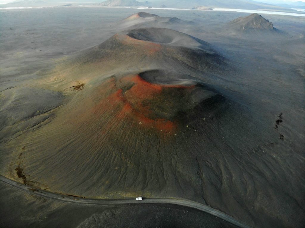
We then drove further north on the F208 and wanted to go to 2 other volcanoes, which also show their full splendor only from the drone. From below you probably would not even stop and just drive by, but with the drone you can make really cool photos. After that was done, we drove back a bit, because we had decided on the way back for the F235 and against the northern F208.
The F235 offered then again a lot of fords, but all were doable. The landscape was again beautiful and varied and we felt like on our trip through the Puna de Atacama in Argentina. At the end the highland road led to the northern part of road 26.
From there we had to drive a bit to our accommodation, which was not far from the Golden Circle. A super long day with perfect weather and incredible landscapes took its well-deserved end after almost 14 hours.
Do you have any questions about the highlights of Landmannalaugar? We would be very happy about a comment!


