Kauai is one of the most beautiful and also most pristine islands of Hawaii. Besides the well-known highlights like the Na Pali Coast and Waimea Canyon, Kauai is clearly the hiking island for me. On no other Hawaiian island we have experienced such cool and varied hikes. Kauai reminded us a bit of Madeira Island, which is also very popular with hikers.
We would like to present you the best hikes on Kauai together with tips and tricks for unforgettable experiences during your Hawaii round trip.
Hotel Recommendation on Kauai
Hotel Recommendation
The Kauai Beach Resort is located in the capital Lihue near the airport directly on the beach. So you are not only quickly in the sea but also very quickly to all corners of the island. You get comfortably furnished double rooms and a super cool pool.
- perfectly conveniently located in Lihue
- super cool pool
- manageable, quiet hotel complex
- very good organic breakfast
#1 Kalalau Trail | The Most Beautiful Kauai Hike
The Kalalau Trail is probably the most famous and also the most popular hiking trail on all of Kauai. It runs for 35 kilometers along the spectacular Na Pali Coast and offers you panoramas that are out of this world.
There is also a mini version of this hike that takes you to Hanakapi’ai Beach and after a few kilometers to the impressive Hanakapi’ai Waterfall. This hike is quite demanding, but can be done by everyone and especially in one day.
Therefore, this hike is our #1 recommendation on Kauai and should be part of every visit.
You run here most of the time along the steep coast of the Na Pali Coast and have the over 1200 meter high mountains and the turquoise blue Pacific therefore always in view. Especially if it has rained shortly before it is extremely muddy here and since you also have to cross a river several times, your shoes will never look like before.
After you have arrived at the beach and had a little cool down (at least in summer), you can walk another 3 kilometers to the Hanakapi’ai waterfall. For this you have to go inland and walk through dense jungle. The waterfall is over 100 meters high and offers a really impressive spectacle.
In total you will need 5-6 hours for the way there and back and collect unforgettable impressions on the way.
Read more about the Kalalau Trail here: Kalalau Trail on Kauai I All about the Na Pali Coast Hike
Short information about the Hanakapi’ai Falls Trail:
- Length: 12.2 km
- Loop trail: no
- Altitude gain: 712 meters
- Difficulty: difficult
- GPX: Hanakapiai Falls Hike at Alltrails
#2 Kalalau Lookout Hike
Right next to the official Kalalau Lookout starts an unofficial (but not forbidden) hiking trail that leads you along the cliff almost to the Na Pali coast. This is one of the best hikes on Kauai, because on the one hand the trail is very challenging and on the other hand you have almost continuously spectacular views of the coast, the Pacific Ocean and the mountains.
Often you walk so close to the loamy quarry edge that you should be quite free of giddiness. But it is not really dangerous, although nothing is blocked or secured here. You don’t have to walk all the way to the end to get wonderful views of the sea. If you have no more time or desire, then simply turn back.
How do I find the entrance to the trail?
You will find the access to the trail to the left of the official viewing platform. Go left past the fence and along the back side of the fence. Then follow the trail until you come to another fence. Here you have to climb through a small gate. Then the path continues downhill towards the spectacular cliff.
Short info about the hike:
- Length: 3.42 km
- Circular route: no
- Difference in altitude: 213 meters
- Difficulty: medium
#3 Kuilau Ridge Trail | One of the most Beautiful Hikes on Kauai
At the Kuilau Ridge hike, there is only one very small official parking lot (Google Maps), which fills up very quickly. Other parking options are unfortunately rare in the area.
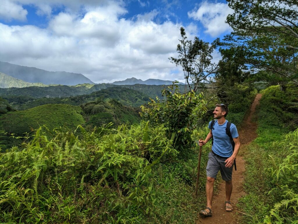
It then goes along a wide path that leads you slowly but steadily uphill through a dense forest. To the left you have a wonderful view over the hilly rainforest landscape. Almost at the top you will walk on the eponymous part of this hike, namely the Kuilau Ridge, a narrow mountain ridge.
This means you hike over a narrow ridge and have a wonderful panorama to admire on your left and right. In good weather you can even discover the mountains of Waimea Canyon from here.
You will come to a small picnic area with tables and benches. The path continues a little bit further and even goes downhill. We thought we had taken a wrong turn somewhere, but the path was correct. After a few hundred meters along narrow – and partly very muddy paths – you will pass a small (and not very spectacular) waterfall and an old wooden bridge.
This is the end of the hike. From here starts the challenging Moelepe Trail, which takes you another 3.5 km into the forest. If you don’t want to do this as well, then turn around and hike back to the parking lot.
Short information about the hike:
- Length: 5.8 km
- Circular route: no
- Difference in altitude: 200 meters
- Difficulty: easy
- GPX: Hike at Alltrails
#4 Ho’opi’i Falls Trail
The Kauai hike to Ho’opi’i Falls is not that easy to find. There is no official parking lot, but you have to park next to the road. You’ll have to pay attention here, though, as many areas are marked “no parking”. There are also several ways to enter the forest, you can find the path we used into the forest here on Google Maps. But be careful, it is hard to find, because it is only a small gap in the bushes.
The first part of the path is flat through dense forest. Soon you will notice that there are several parallel paths, but they are not marked. If you follow the left path you will walk directly along the rushing brook, which is a bit adventurous. You will then automatically pass the first small waterfall.
From here you will have to climb up a very steep, albeit short, path to reach the parallel hiking trail that will take you further in the direction of the second waterfall.
As you continue along the path, the forest becomes more and more like a jungle. The trees pile up majestically next to you and are also hung with climbing plants and lianas. This looks quite spectacular.
When you reach the second waterfall, the path splits again. The left path leads to a viewpoint from which you can admire the waterfall from above. From here it’s again an extremely steep path uphill (here you have to climb again or go back to the fork) to get to the path that brings you to the foot of the waterfall.
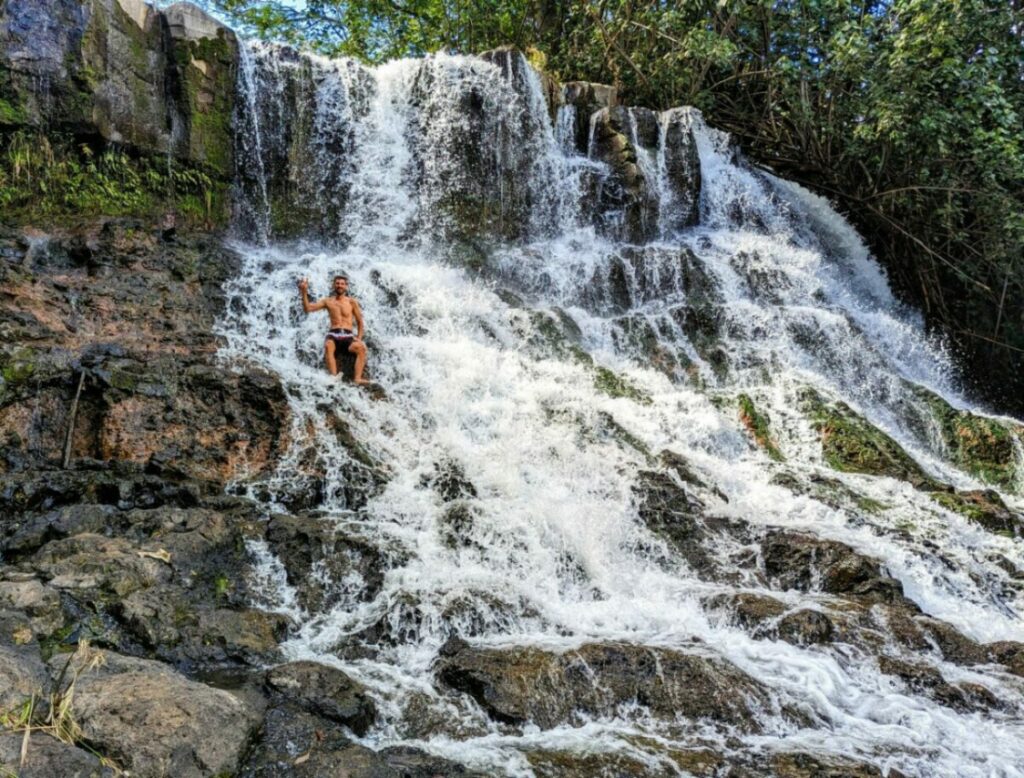
After just under 100 meters, an unsecured path descends very steeply and takes you back to the river and the foot of the waterfall. Here you have the opportunity to go swimming (the water is super clear and not even that cold) and to swing into the water from a rope hanging down from a tree here. This was very unique and makes it one of the best hikes on Kauai.
The nature here at the waterfall, as well as along the entire trail, is really beautiful and we almost felt like we were in Costa Rica. That’s how strong the rainforest atmosphere was.
On the way back, you can then take one of the parallel running paths and can thus virtually run a circular route.
Short info about the hike:
- Length: 2.9 km
- Circular route: possible
- Difference in altitude: 50 meters
- Difficulty: easy
- GPX: Hike at Alltrails
#5 Sleeping Giant Hike
The hike up Sleeping Giant is actually called Nounou Mountain and is called Sleeping Giant because the mountain in eastern Kauai that you climb looks like the face of a giant lying on his back. It takes a lot of imagination to see the silhouette of a man in this mountain, but hardly any imagination to imagine how great the panorama must be from above.
There are two trails to the summit, the East Trail and the West Trail. Both are about the same length and challenging, but we’ll introduce you to the West Trail here, as you’ll walk through a beautiful forest with huge pines at the beginning.
You can find the starting point of the hike here on Google Maps. Attention, there is no real parking lot here, but you park in a residential area with very limited parking.
Right in the first part of the hike with the huge pines it is beautiful, even if the beauty is somewhat marred by the many mosquitoes here. So don’t forget your anti-mosquito spray.
The trail continues through beautiful mixed forest and it also starts to climb quite steeply. Shortly after, the two ascent variants (East & West Trail) meet and run together towards the top.
And from here it starts to get really adventurous because the trail now really runs over hill and dale. Not far and a real via ferrata follows. You have to climb up steep rocks and pull yourself up branches.
Then you reach a rock that offers you a 360° view of Kauai. Directly under this rock, a narrow path leads to a small cave, which is a great photo motif on the hike.
If you go a little bit further uphill you will come to the highest observation deck, where you have a wonderful panorama. When you have seen your fill, you can start your descent again. We needed for ascent and descent in each case just under an hour.
Short information about the hike:
- Length: 5.5 km
- Circular route: no
- Difference in altitude: 293 meters
- Difficulty: medium
- GPX: Sleeping Giant Trails at Alltrails
#6 Okolehao Trail
High in the north of Kauai near the tourist town of Hanalei lies a small but very nice hike. This trail first takes you through a dense and very muddy forest in which it is very easy to get off track thanks to the lack of signage. After you have left the flat and muddy part behind you, it already goes steeply uphill.
On the way you won’t have a view, but you will have the chance to see many different animals like birds and frogs.
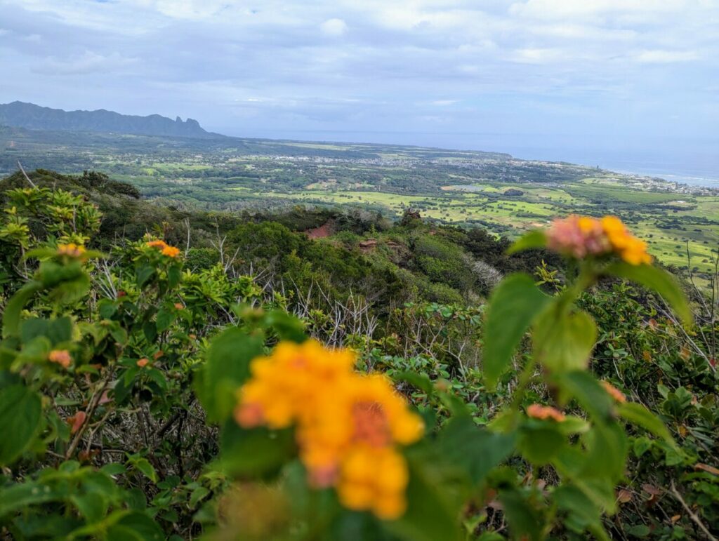
The last 10 meters of the hike are very steep, but luckily there is a rope to pull you up. At the top you have a really cool view all the way to the sea.
If you still have strength and desire you can continue the trail and then after about 2.5 more kilometers you will reach the Hihimanu summit. The views are not necessarily better on the way, but here are extremely many meters in altitude to manage.
Short information about the hike:
- Length: 4,2 km (without the part to the Hihimanu summit)
- Circular route: no
- Difference in altitude: 250 meters
- Difficulty: easy
- GPX: Okolehao Trail at Alltrails


